|
|
|||||
Dumbell 8421, Greenwood 8415, Genius 8039(USGS Holden)August 26-27, 2006 |
|||||
|
|
|||||
|
|||||
|
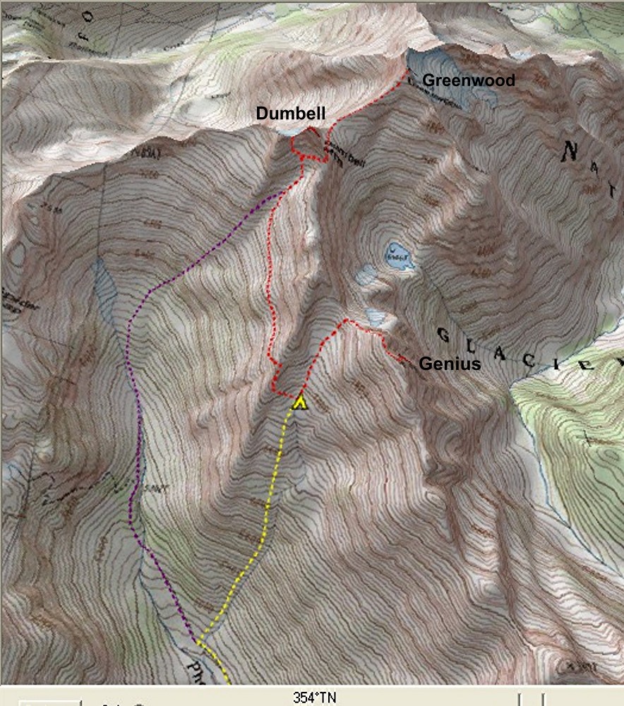
Introduction: For this trip, we took the Phelps Creek trail to the creek below Genius at 4800, followed the creek up to camp at 6900, and did a sunset ascent of Genius. The next morning we traversed to Dumbell, scrambled up Dumbell & Greenwood, and retraced our path back home.
|
|||||
|
|||||
|
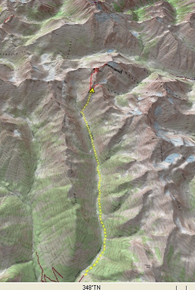
Report: Approach We left Fremont at 7:30am, drove to the Phelps Creek TH, and were on the low-angled trail at 11:15. We stopped to refill with water at Leroy Creek. The October 03 floods left their mark here. Where Leroy had once had a single channel, now there were fields of water-washed rocks spreading for dozens of yards alongside the stream.
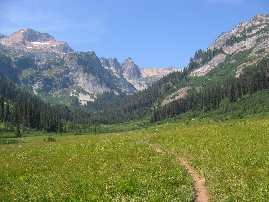
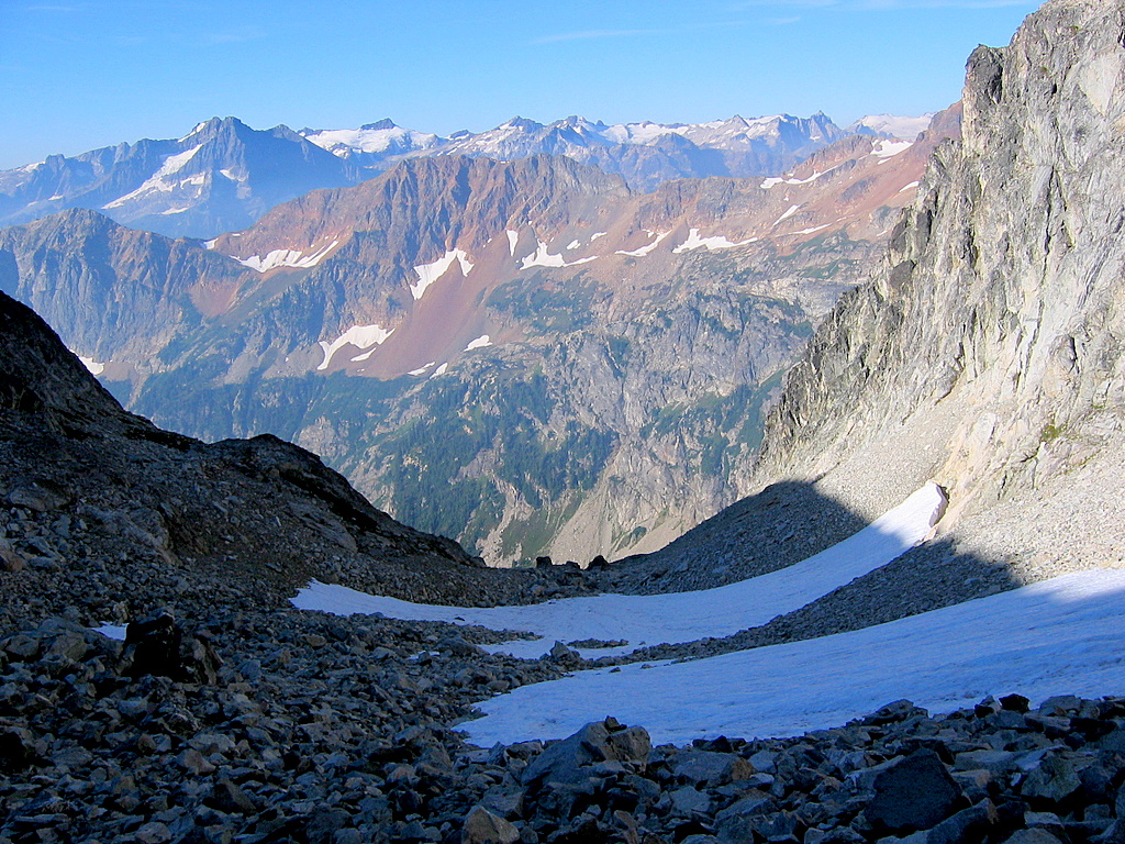
Then we continued through the woods to Spider Meadow. Spider Meadow was very flat and green as usual, but the fires out east made the views very hazy. We hiked another half mile across the meadow and found the stream coming down from Genius at about 4800 feet.
We followed the right-hand (nearest) branch of the stream upward, staying on the left side. A few hundred feet up, we had to hang onto brush to squeeze by two steep wet steps. A couple hundred feet above that, we got into brush which lasted about a hundred feet before we got out. Looking from below later, we probably should have just pushed straight up through the brush and gotten out of it sooner. Above that, we followed the stream through steep meadows all the way up, crisscrossing the stream wherever it was convenient on the higher parts. At 5:15pm, a small basin at 6900 provided a nice camp (also the only camp) with water, a few trees, and a dusty flat spot for the tent.
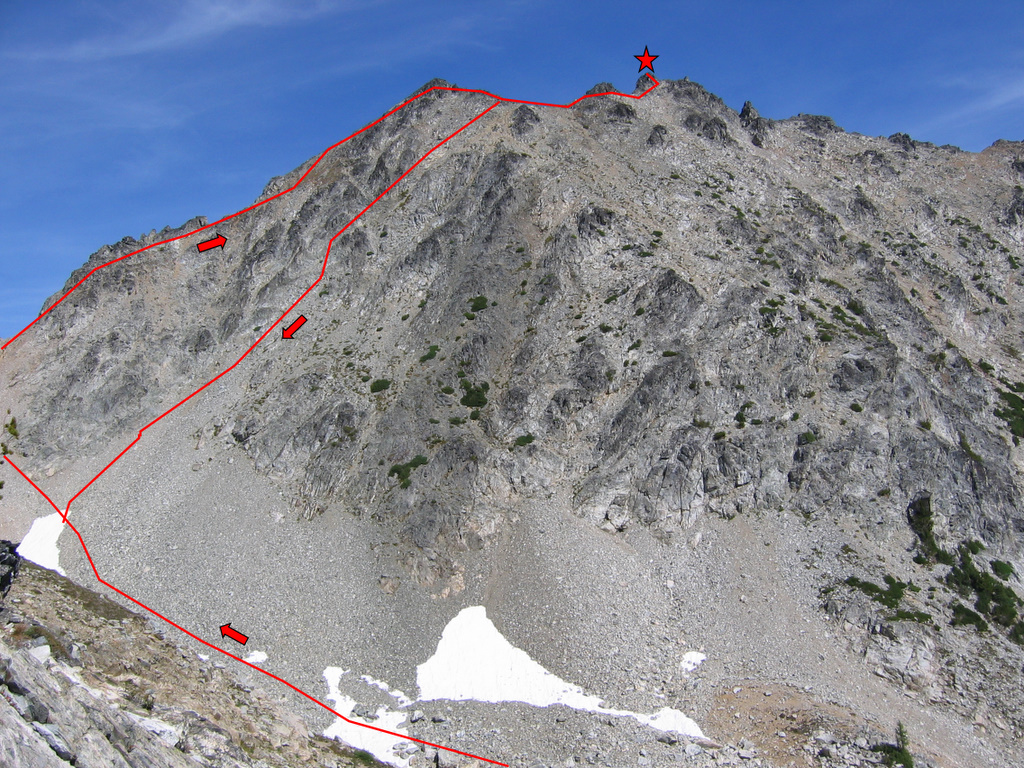
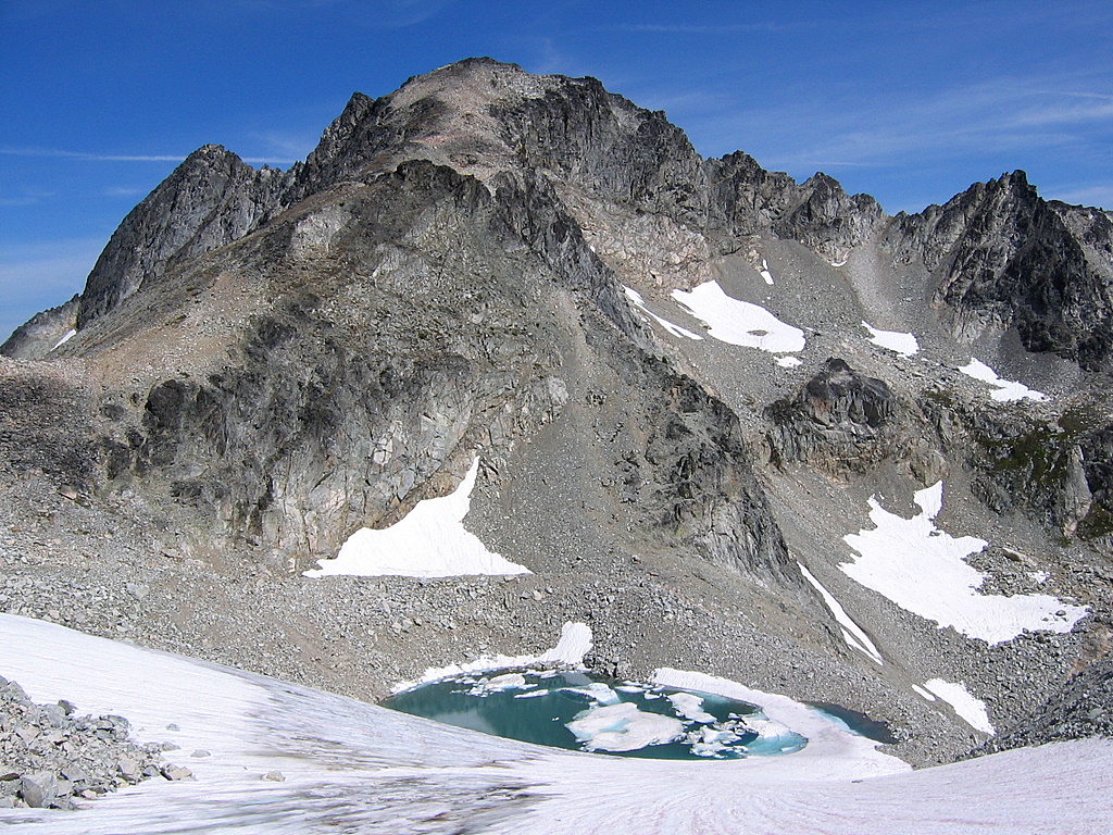
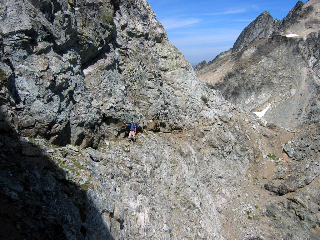
Genius From camp, you can almost see the summit of Genius, up high and off to the right above some rock bands. Before heading up to Genius, I heated some water, mixed my freeze-dried meal, and stuck it boiling hot in my summit pack, figuring I’d eat it at the col. The talus going up was mostly okay, but loose in some spots. We angled up the slope to the right of the lowest col, to avoid an outcrop immediately right of the col. Semi-solid second-class rock led up the crest to the false summit, which provided a comfortable spot to finish my meal. Then we went over to the narrow and pointy summit. We searched but couldn’t find the reported summit cairn anywhere.
|
Spider Meadow
Genius Summit Route
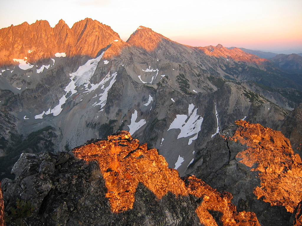
Genius Summit Sunset
|
||||
|
Genius gives a fine view of the wall of the Copper/Fernow/Seven-Fingered-Jack/Maude range to the east. As sunset arrived around 8pm, I watched the shadow line creep higher on the wall, leaving a narrowing band of alpenglow across the crest, deepening from dusky gold to orange to deep red. To the north, we could see tomorrow’s goal of Dumbell & Greenwood, with Bonanza’s summit neatly positioned in the intervening col. As our summit dropped into shadow, the descending sun cast an eerie light onto the rocks underfoot. The dim red light was actually shining upward from below us, so that the rocks were grey in the twilight, but the undersides of the rocks glowed with a deep molten glow.
|
|||||
|
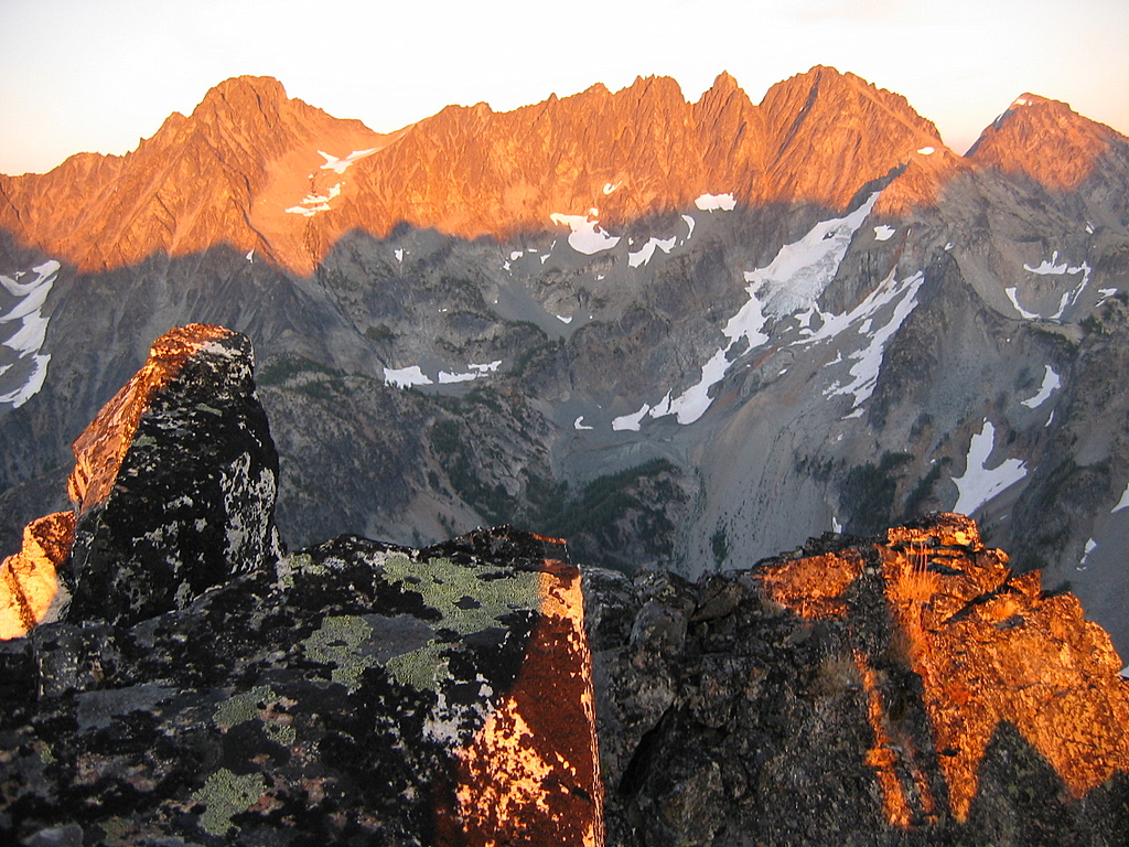
Fernow - Seven Fingered Jack - Maude at sunset from Genius |
|||||
|
Descending back to camp, the clear skies stayed just bright enough to get down all the rocks, but we had to turn on our headlights for the last few minutes on snow, reaching my tent at 8:50pm.
|
|||||
|
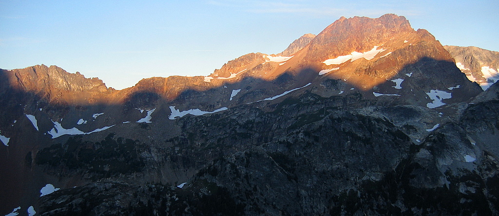
Sunrise on Chiwawa - the shadows are the ridge we're traversing to Dumbell.
|
|||||
|
Dumbell & Greenwood At 6:15 in the morning, we left our camp in place and traversed to Dumbell. We had departed before sunrise, so the rising sun neatly amplified the red color of the peaks to our west, making Chiwawa & Red Mountain glow like bright red above the dark shadowed valley. As the day grew lighter, the peaks became hazier in the smoky air from the east-side fires.
|
|||||
|
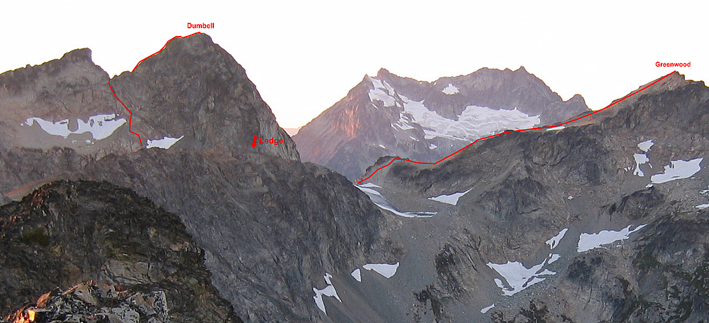
Without much trouble, we scrambled up onto the nose north of camp, where some clumps of trees marked broken ground. Now we were ready to traverse, but alas, there was a cliff-sided gully ahead. So we climbed up to the crest and crossed above the gully it. Again we were ready to traverse, but alas, there were rocky walls near the crest. So we kept getting pushed down to pass below the walls. After negotiating a few more gullies and obstacles, we reached more open slopes. We were very ready to traverse, and thus we did, following various talus, meadows and slabs to reach the gully below Dumbell at about 7400 feet.
Dumbell’s south face looked steep but turned out quite straightforward. At the bottom center of the face was small snow patch. From there, ramps led left to a distinctive fault, which led further up the left half of the face to the notch between the true and false summits. The fault formed first a ledge and then a narrow cleft going up to the notch. On the way up, we bypassed the cleft by climbing on steep ramps just before the cleft, but it was rather exposed class 3+. On the way down, we stayed in the cleft, which was steeper and had some loose rocks, but reassuringly enclosed with lots of holds. From the notch, simple rock scrambling led to the summit.
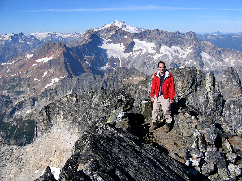
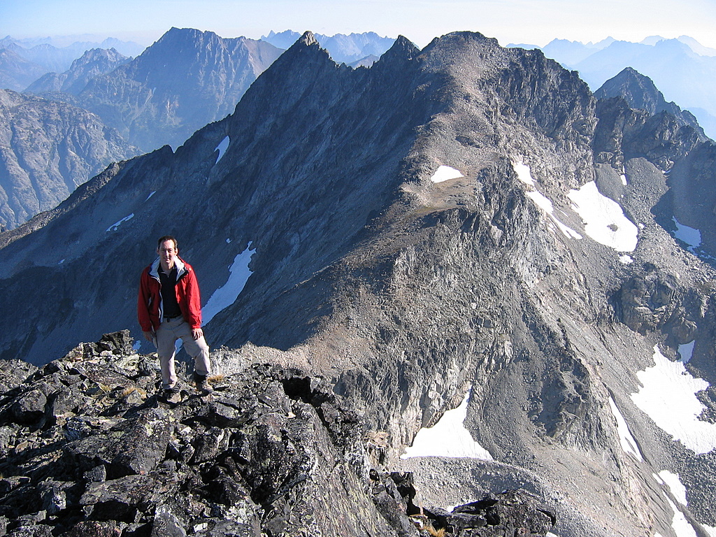
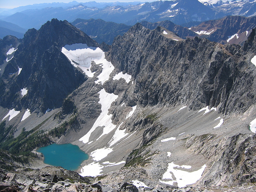
From Dumbell’s summit, the peaks westward were lined up in neatly rising tier – Dumbell’s false summit, then Chiwawa, then Fortress, and finally Glacier. Eastward we could see the wide easy slopes leading to Greenwood from the col. At the base of the col was something even more enticing, a snow-rimmed lake filled with floating icebergs, daring me to swim out and climb up on one of the icebergs. Now, to get to both Greenwood and the lake, I’d either have to take a five hundred foot dive off the NE cliffs or else go down and find the famous ramp to the col. |
Phelps Valley from gully below Dumbell
Dumbell Summit looking west to Glacier
Dumbell summit looking east to Greenwood
|
||||
|
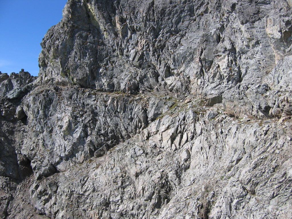
So we descending back to the little snow patch and traversed east to the nearest notch on the right side below the face, circa 8000 feet. Sure enough, there was a ramp, leading around a corner toward Greenwood. Beyond the first corner, it turned a corner again, and then curved onward following the face in and out for hundreds of feet to neatly deposit me us onto easy terrain above the col. I thought the ramp was great fun to walk – narrow but with solid footing all the way, so that the exposure was exciting rather than intimidating. |
|||||
|
Eric Traversing the Ledge from Dumbell to Greenwood
|
|||||
|
Beyond the ramp, we followed moderately steep snow down a to the 7700-foot col. It was fortunate we’d done Dumbell first, so that the morning sun had softened the snow enough to kick steps. Then we scrambled big easy talus up to Greenwood. We enjoyed the famous Greenwood summit register – a large tin can, with “Boy Scouts of America” stamped into the side, containing the original 1937 entry from a guy who thought he was on Fernow.
Each direction from Greenwood had a different kind of view, both above and below. Southeast was the multi-summit wall of the Fernow-Maude crest. Far below in the Railroad Creek valley, we could glimpse the flat orange top of the Holden mine tailings pile. South across a deep hole was Greenwood, with Lake 6466 shining pretty green-blue below it. West were Buck, Clark, Chiwawa, Fortress and many others, all leading up to the high snow of Glacier. To the right of Chiwawa, the Lyman Lakes were barely visible, with the Suiattle Pass peaks beyond them. North was the huge Isella Glacier face of Bonanza, dropping a full vertical mile back to the Railroad Creek Valley. Below and further northeast was a glimpse of Lake Chelan. And east the sky was simply a haze of fire smoke, with the Chelan Sawtooths occasionally forming shrouded outlines angling high up in the haze.
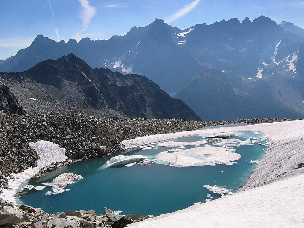
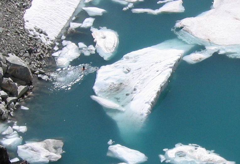
On the way back, I took a quick swim in the iceberg lake at the col. The bigger icebergs were too steep to climb up, so I climbed up on one of the smaller ones. In the hot sunlight, it wasn’t actually that cold, except for the snow underfoot freezing my toes. Afterward, my skin held a refreshing chill countering the hot day as I climbed back up to the ramp. Going back across the ramp, Eric and I exchanged cameras so we could take pictures.
Looking down the Dumbell gully to the head of Spider Creek, it looked like straightforward terrain, and we wished we had brought our packs rather than have to repeat the traverse back to camp and descend the steeper, brushier Genius gully. On the return traverse to our camp, we dropped a couple hundred feet lower at the start, so we could stay at the top edge of the meadows rather than in the steeper rocks. At the last nose, we climbed up to avoid the cliffy gully then back down 150 feet to the trees where we had arrived, and dropped back to our camp at 3:30.
Exit Going down the gully, we got into some thicker brush, but got down okay. Looking back up from below, we could see that we should have stayed closer to the creek, where the brush bands were narrowest. Then we hurried back down the Phelps Creek trail, glad that it was wide and easy to follow as the light faded and we arrived at the car an hour after sunset at 8:45 |
|
Greenwood from Dumbell-Greenwood col
Genius from Greenwood
Dumbell-Genius Col
Swimming in the iceberg lake |
|||
|
Matt crossing the Dumbell ledge returning from Greenwood
|
|||||
|
Statistics: Approach: 7.4 miles, 3400 gain. Genius: 0.7 miles, 1100 gain, one way. 1.4 miles, 1100 gain round trip. Dumbell & Greenwood: 2.3 miles, 2350 gain, 500 loss one way. 4.6 miles, 2850 gain round trip. Exit: 7.4 miles. Total trip: 20.8 miles, 7350 gain.
Pictures & Maps:
|
|||||
|
|||||
|
|
|||||