|
[ MtnVista Home Page ] [ Family Home Page ] [ Mountaineering Home Page ] [ Recent Updates ]
  
|
Booker & Horseshoe, Part 2
(USGS Cascade Pass, GT
Cascade Pass)
July 15-17, 2006
|
|
This page includes Days 2 & 3 of
the Booker/Horseshoe trip report.
For Day 1, please
click here.
|
|
Day 2: Booker & Horseshoe Summits, plus a
Bonus Sunset.
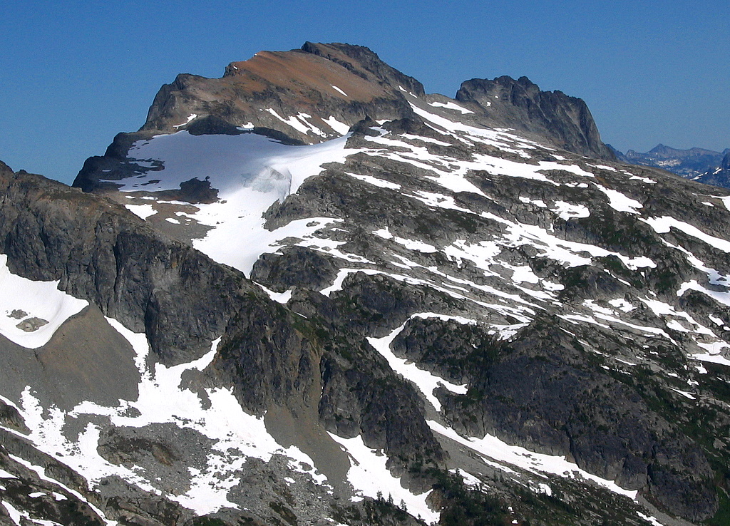
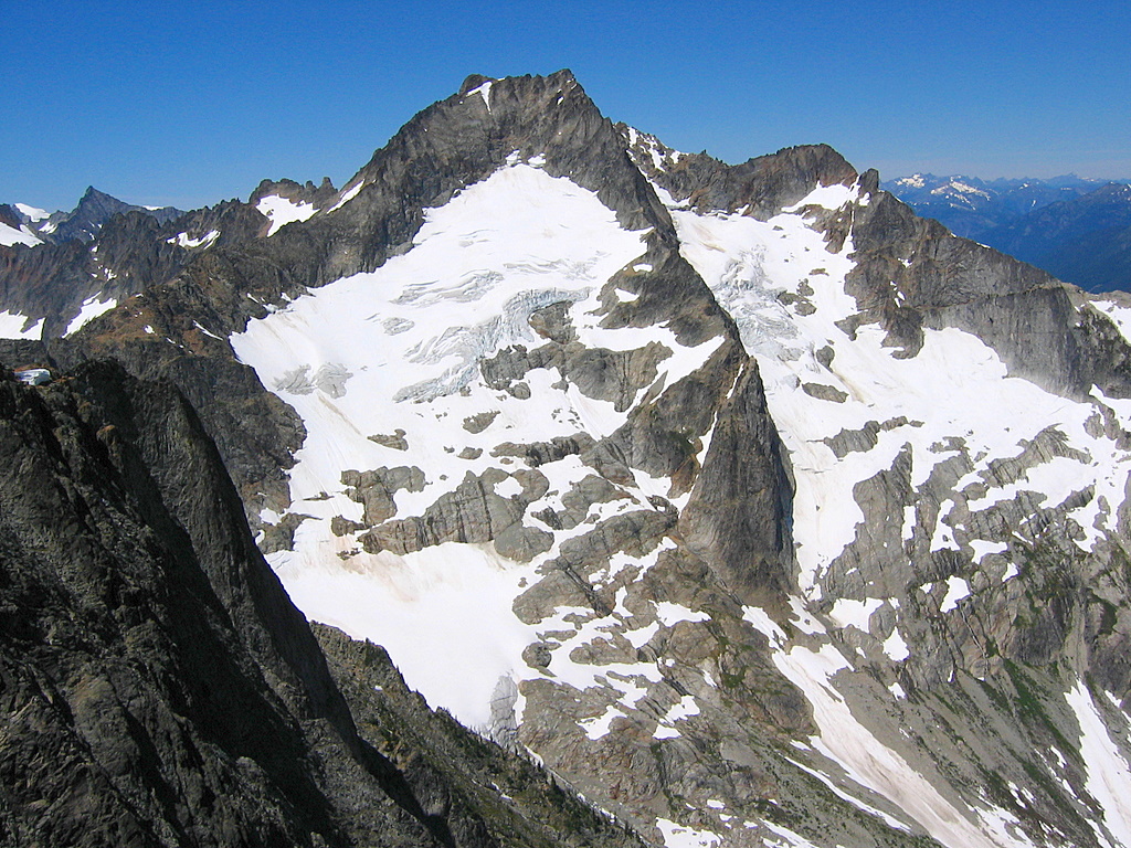
Booker The route to Booker had two obstacles we expected
(a nose before the Booker/Buckner col and the notch in the summit ridge),
and one obstacle we didn’t expect (a hidden gully in between).
We set off from camp at 7:15am and traversed around
the basin, keeping our elevation around 6500 so we could pass below the
nose. A black bear was browsing on the meadow, but it ran off downhill
long before we got close. We crossed below the nose and headed up the
wide gully toward the Bucker-Booker col. A couple hundred feet below the
col, we angled off toward the right to avoid a small pocket glacier at the
col. We didn’t want to get onto the summit ridge itself, because it has a
fifth class notch dividing the near end from the summit at the far end.
Instead we angled to stay below a cliff band at the bottom of the summit
ridge until we could enter the notch from below. Along the way, we were
surprised to find our path blocked by a steep drop-off into hidden gully
(though in hindsight it’s visible on the map). We got around it by
dropping about 150 feet; one could also go around the top a couple hundred
feet higher.
Eventually we stopped to debate the location of the
summit notch, because, from below, it’s visible only as a big gully in the
cliffs, not a notch high above. Billie practiced patience while Mike and I
cordially debated for twenty minutes, accompanied by various waving of maps gesturing of arms,
and stomping of feet. Anyway we ascended the gully on snow till it got steep,
then on rock on the right-hand side. Higher up it turned to lower-angled
pebbly ground, barren except for tiny bunches of flowers popping out
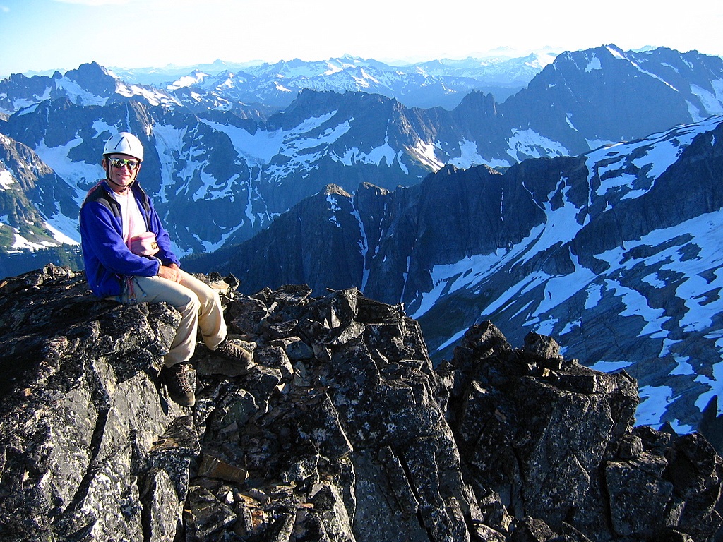
unexpectedly. We reached the summit, 8280 feet, at 1:30pm.
|
|
(Click any photo to enlarge)
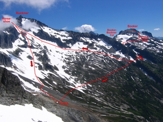
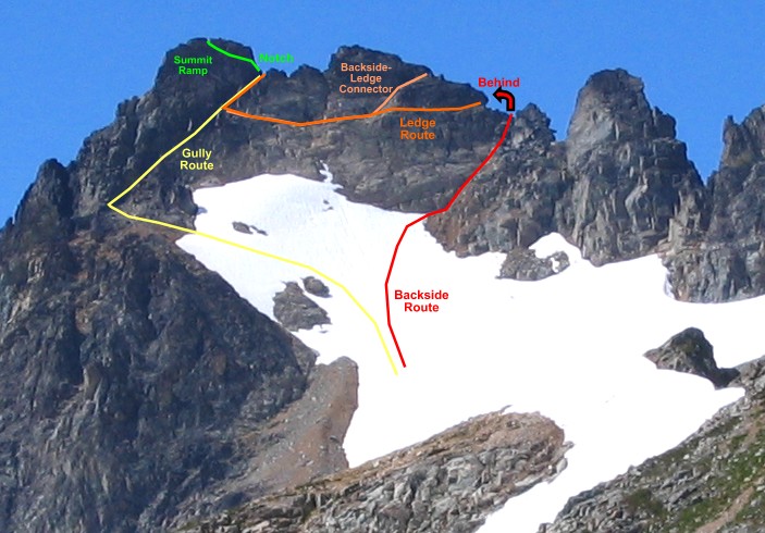
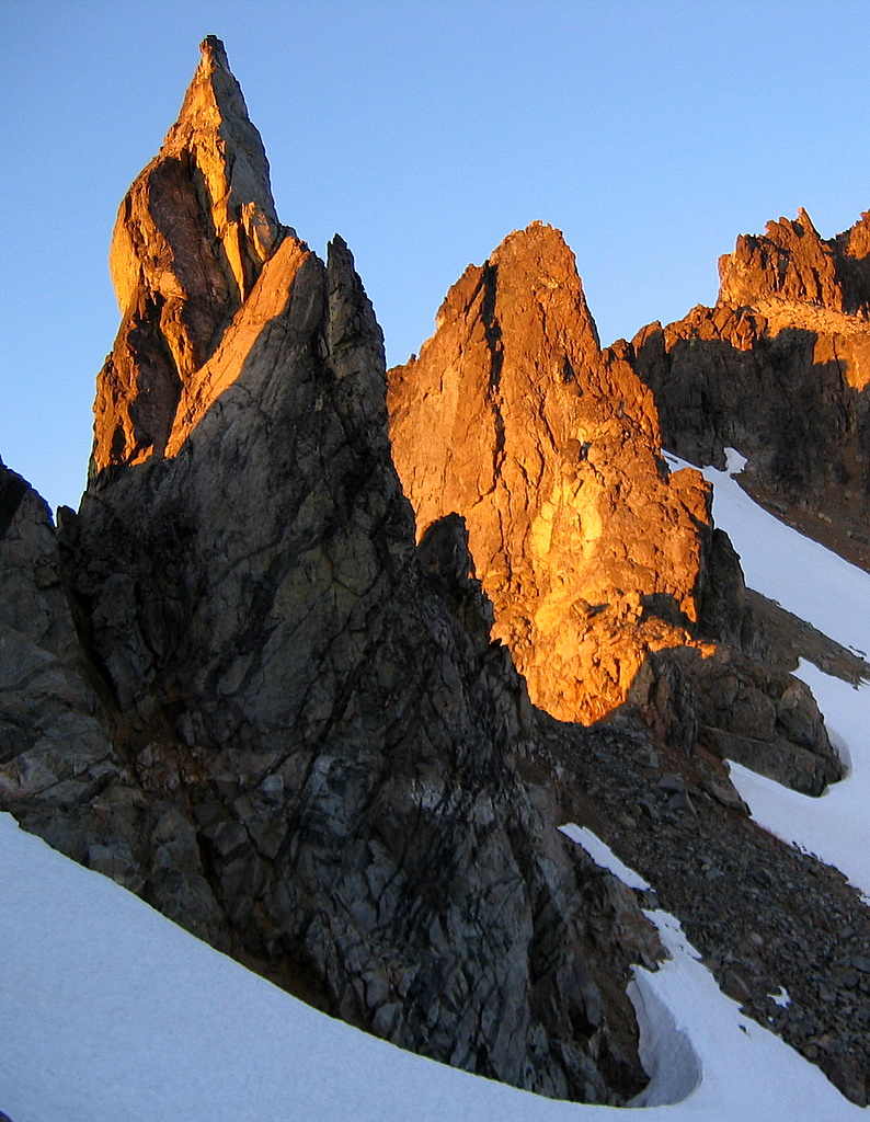
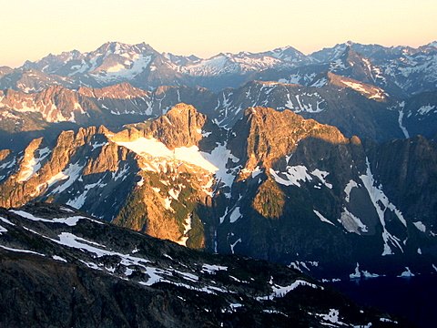
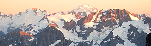
Summit Routes
Booker |
|
|
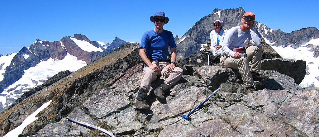
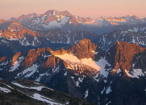
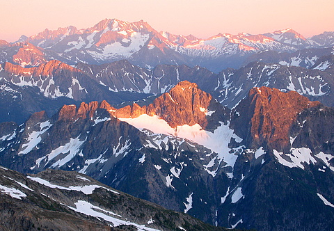
Horseshoe Summit Group |
|
|
|
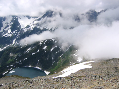
The summit provided dramatic views in
every direction. South was the deeps of the Stehekin River valley,
the blue oval of Trapper Lake, and all jumbled pile of peaks out past the
Ptarmigan traverse. West we could see the vertical sweep of
Horseshoe Basin, including the steep waterfalls dropping off the edge into
the lower basin. |
|
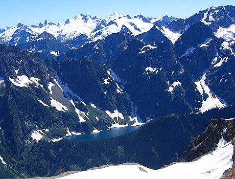
Trapper Lake |
Horseshoe Basin |

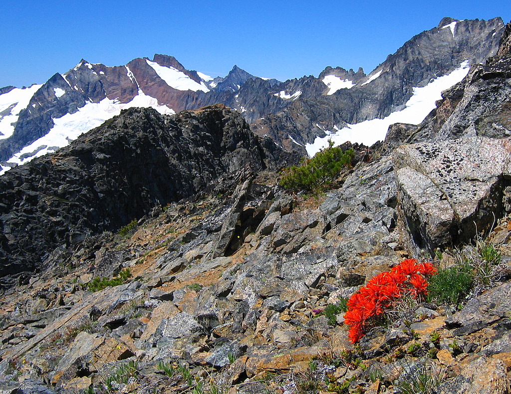
Paintbrush high on Booker |
|
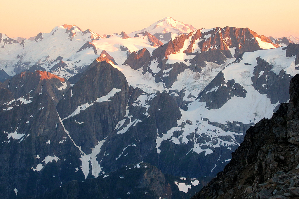
To the north, Buckner towered up out of
the valley. Best of all was the view east to Logan, Storm King, and
Goode, on the far side of Park Creek. Wow, what a steeply cut
valley! All along the far side, huge cliffs ran miles long and
thousands of feet high below the peaks. On our own side, more cliffs
dropped off so sheer that we couldn’t see the wall below us at all. |
|
Buckner |
Logan & Park Creek Pass |

Park Creek Valley, Storm King, & Goode |
|
|
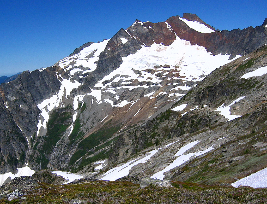
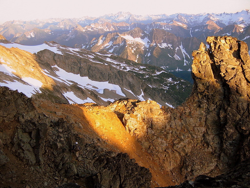
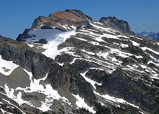
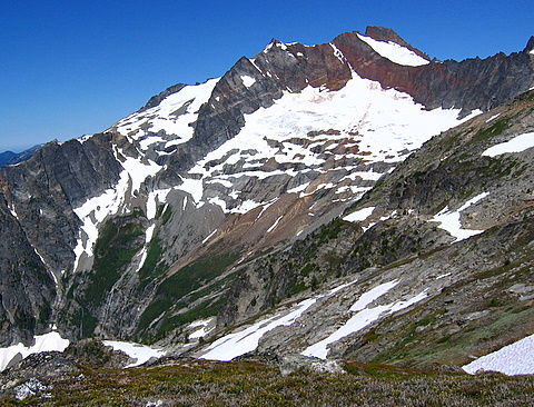
Horseshoe
At 2:30 we headed back down and reached the 6500-foot
nose at 3:45. From there, Billie returned to camp while Mike and I angled up
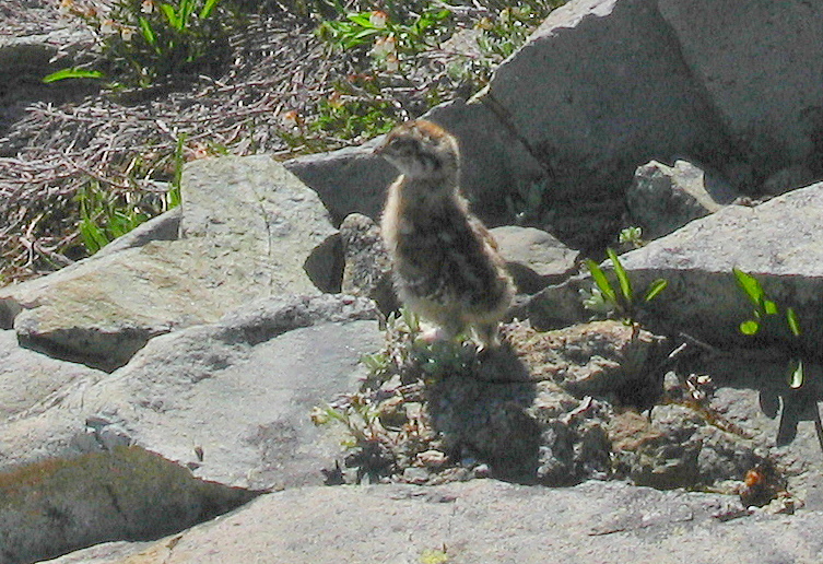
toward Horseshoe. Along the way, I saw a ptarmigan with a baby chick, and
made the poor mother ptarmigan miserable by following them around to take a
photo while she tried to decoy me away from the chick. Eventually we reached
the high corner between Ripsaw Ridge and Bucker, and angled left up to the
snowpatch below Horseshoe's summit rock.
(Horseshoe is the most questionable peak on the Bulger
Top 100 list, because it has only a couple hundred feet of prominence, and
it’s not really the point that’s named Horseshoe Peak on the map; it’s simply
the highest point on Ripsaw Ridge.)
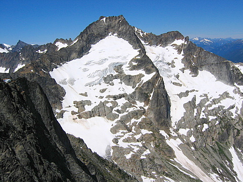
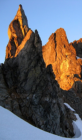
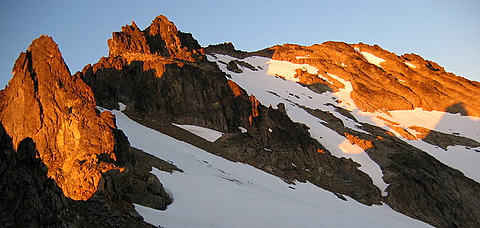
Above the snow, Horseshoe’s summit is a square block,
with a notch up on the left crest that leads to the summit pitch. It
turns out there are at least three ways to reach the notch, all of them steep
and unpleasant. On the left is a steep gully route, which we used for our
return. We went up an easier gully on the right side, but then had to get
across to the notch on the left. Mike had previously gone around the back
side so we started out that way. It seemed awfully steep, so we crossed back
over the crest and followed a high ledge across to the gully a little below
the notch. Looking back from the notch, any of the routes seemed workable,
but they all have steep third class with some fourth class steps. I
liked the left gully best.
The summit is actually a dramatic-looking little pitch,
quite narrow and steep when viewed from the side, but we were hurrying to
finish the day and I forgot to even take a photo of it. Up above the major
notch, a steep narrow ramp angles up to the only technical move, a
questionably protectable pull up over a rotten lip into a little notch below
the big summit rock. Mike was thoroughly lacking in enthusiasm about
repeating this notable summit, so I led the pitch and arrived at 7:30pm, 8440
feet. Now we had views north across the wide white expanse of the Boston
Glacier, but it was late, so we tied a quintuple length of runners around the
big rock for a rappel and headed back down.
|
|

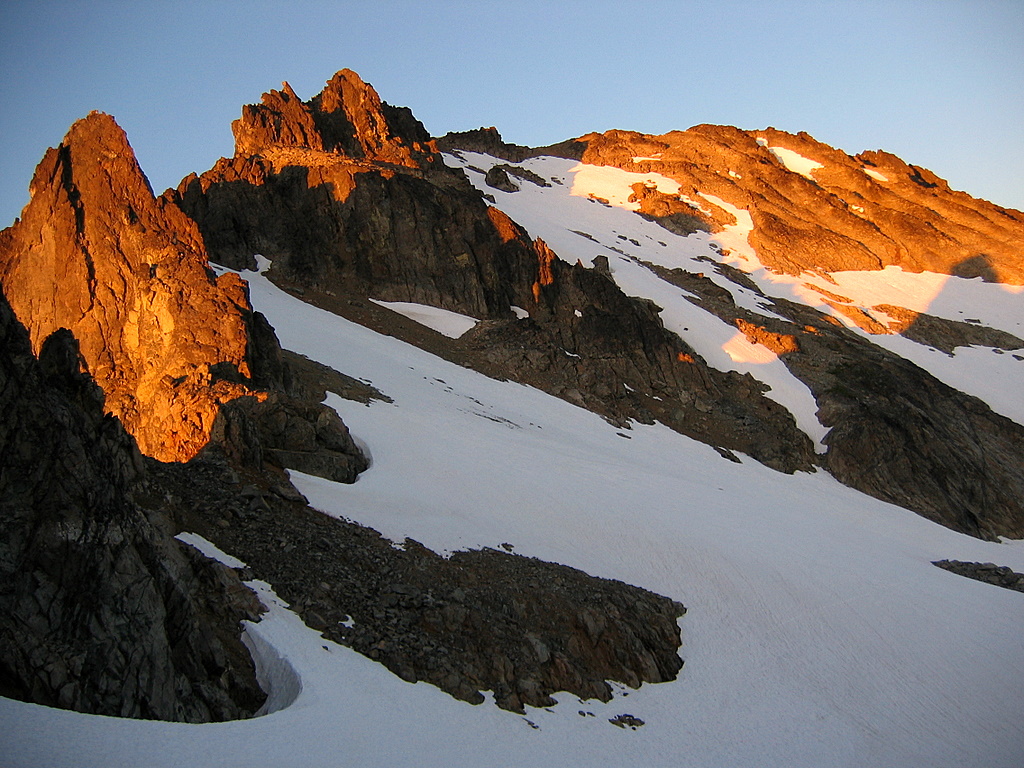
Horseshoe Summit Routes
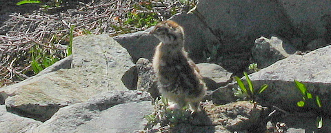
Ptarmigan Chick
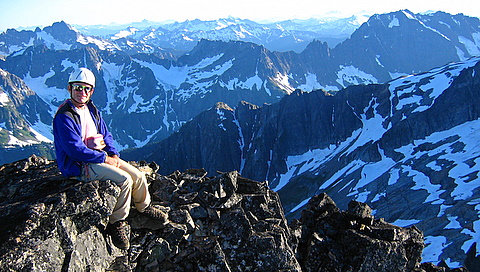
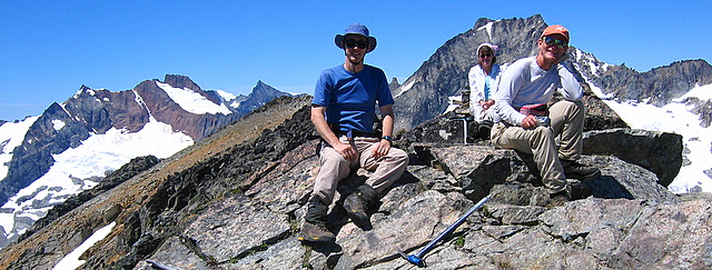
Mike on Horseshoe Summit |
|
|
|
|
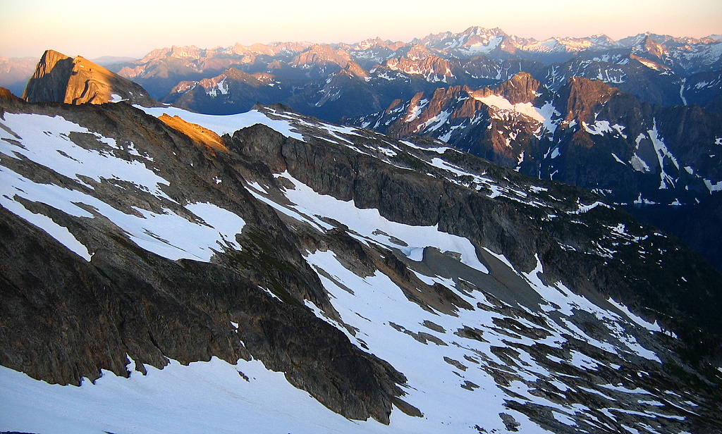
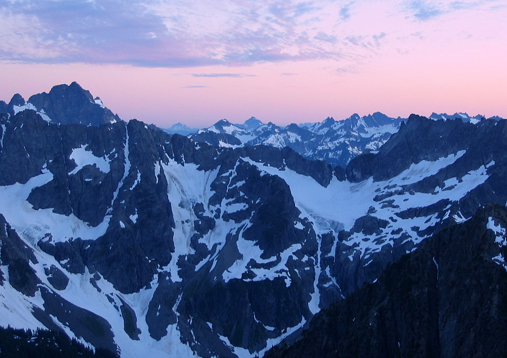
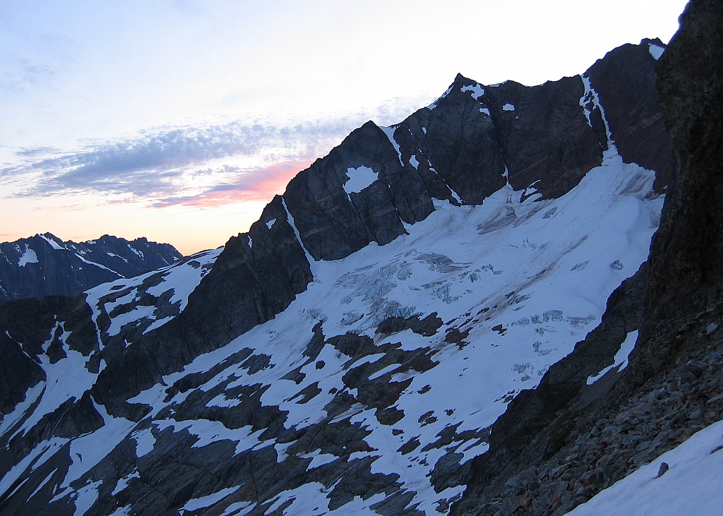
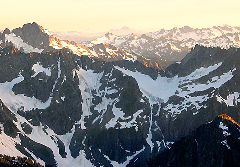
Sunset
As we descended the gully, golden evening sunlight hit
the rocks below, and I remained there on a little col above the snow,
enthralled by the beautiful sunset, while Mike continued back to camp.
The entire Cascade crest south of me was bathed in
warm light.
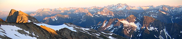
For the next 45 minutes, I enjoyed the show as the
alpenglow angled higher across the peaks and deepened in color.
|
 |
 |
 |
|
Glory & Bonanza as the alpenglow
reddens
|
|
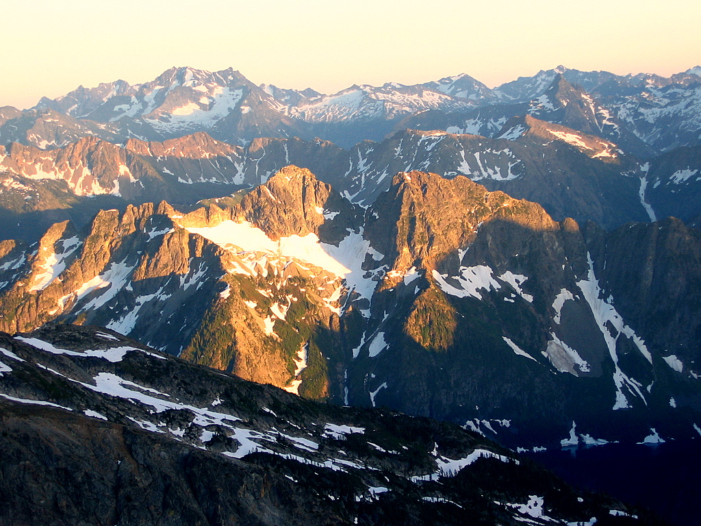
It’s like a drama designed to highlight the
paramount crests – moment by moment, as the sun drops, the shadows climb
and the light intensifies, so only a smaller and smaller selection of
highest summits stand out, shining like gems crowning the darkened world.
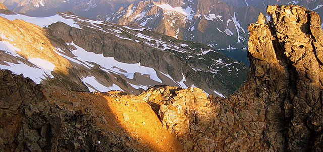
For an additional treat, the sunset also lit up the small nearby tower
called “Lick of Flame,” making it burn like its name. |
|
Lick of Flame |
Dome, Glacier, & Spider |
|
Bonanza & shadow of Horseshoe in last light |
|
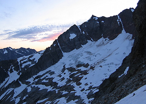
At one point I started to head down the steep snow
near the top, but was stopped again by the view and remained stuck midway
on the cooling snow while the light spanned the spectrum into the sky.
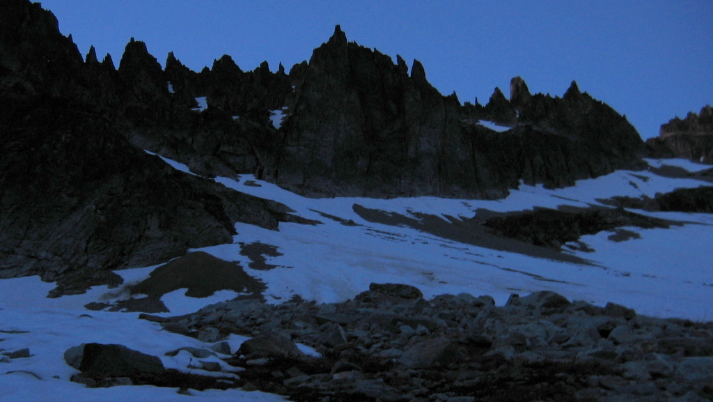
Finally the colors went out and the basin fell entirely into shadow.
|
 |
 |
 |
|
Formiddable & Magic in alpenglow and afterglow |
Horseshoe Basin in shadows |
|
|
The rest of the return trip was low-angled,
and I trotted down the snow with what light remained in sky. I and made it to
camp at 9:45pm with just a brief use of my headlamp on some final rocky
stretches.
After eating my dinner in the dark, I leaned my head back
against the rocks and discovered one last visual treat. Propped up against
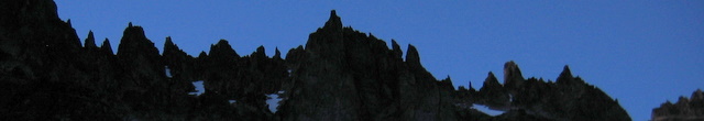
the tiled rock of the basin, if I stretched my peripheral vision to its
utmost, I could see the entire rim of summits as dark silhouettes standing up
in a wide circle against the night sky above me.
|
|
Day 3: Horseshoe Basin to Sahale Arm to Cascade
Pass TH
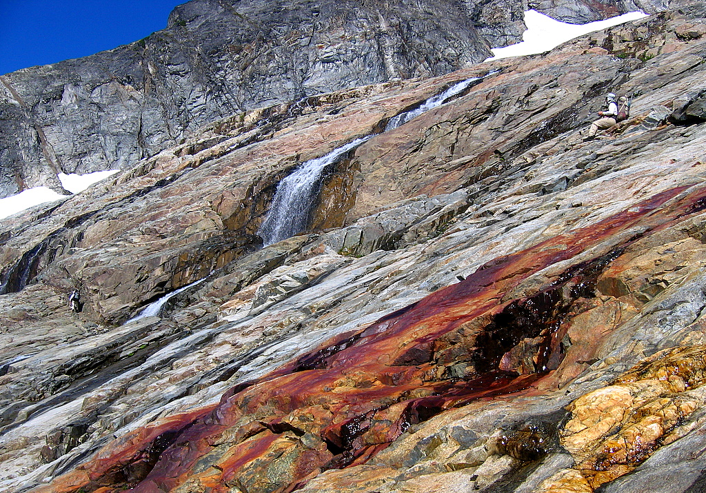
No need to hurry today, so we enjoyed a leisurely
breakfast in the morning sun and left camp at 9:30am. This time we traversed
a little lower back toward the Sahale gully, where a natural ramp led across
the ledges. The narrower path put us right into the spray of some of the
waterfalls.
|
|
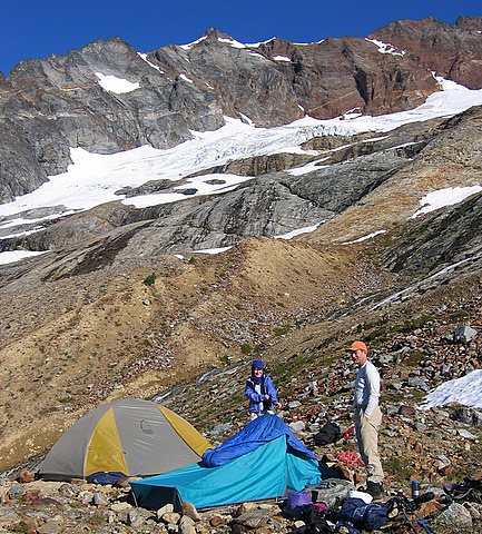
Billie & MIke at camp |
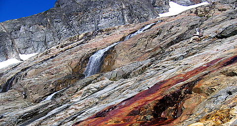
Traversing back to the rib, past mineral runoff
and waterfalls |
|
|
On the first day, I had been surprised to not see any
marmots, but several marked our exit. At the top of the rib, a marmot
was startled by our approach and ran up onto the snow. It put our pace
to shame by ascending all the way up hundreds of feet of snow onto Sahale,
before we even got off the rock.
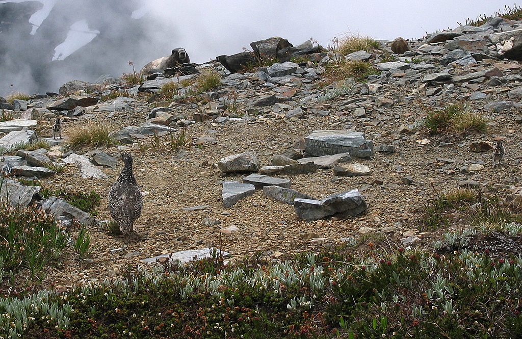
When we reached the Sahale Arm trail, a wet front was
pushing clouds across the ridge from the west side. Descending amid the
swirls of gray blowing mist, the meadows and flowers appeared in rich patches
of green and blue, and animals popped up all along the trail. First a marmot
posed for a close-up. Then a ptarmigan and four chicks ran down the trail
ahead of me! Oh no, the camera memory was full! I had to delete some of my
485 precious pictures of the trip, then hurry to catch a picture of two of the
chicks. Oh, joy, another marmot appeared and posed together with the
ptarmigan and chicks! Eventually I made it to Cascade Pass, where a family
of mountain goats was visible high up Mixup Arm, and trotted down the rest of
the trial to the car at 3:45. |
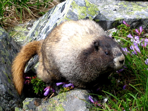
Marmot Closeup |
|
|
Clouds on Sahale Arm |
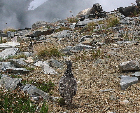
Ptarmigan, Chick, & Marmot |
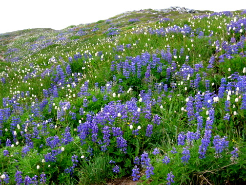
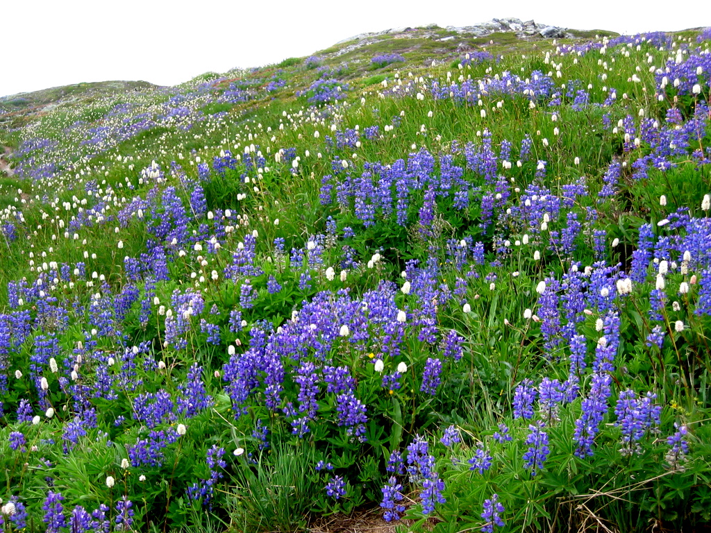
Lupine & Bistort |
|
|
Statistics:
Elevations:
Cacasde Pass TH 1700,
Cascade Pass 5400, High Point on Sahale 7500, Horseshoe Basin Camp 6500,
Booker 8280, Horseshoe 8440.
Approach:
7:30 hours, 6.5 miles,
4000 gain, 1200 loss
Summits:
14:30 hours, 6.3 miles,
4050 gain.
Exit:
6:15 hours, 6.5 miles,
1200 gain, 4000 loss.
Total: 18.3 miles, 9250 gain.
|
|
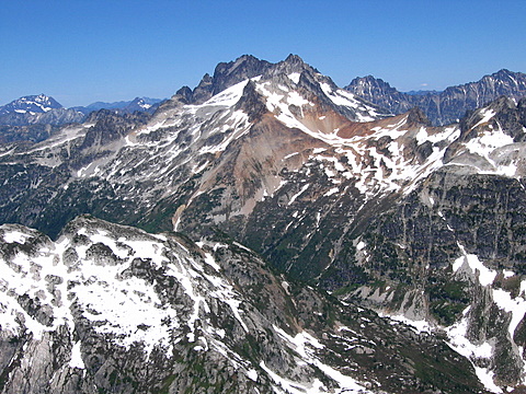
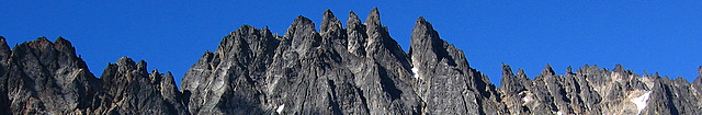
Ripsaw |
(Click any photo to
enlarge) |
Ridge |
|
|
|
|
Camera Footnote:
This trip also marked the point where the
counter on my camera reached 9999 and started over at 0001. So that's
over 10,000 pictures since I bought the camera in December 2003.
.
Pictures
& Maps:
|
|
|
|
|
|
Top of Page
|