|
|
|||||||||||||||||||||||||||||||||||||||||||||||||||||||||||||||||||||||||||
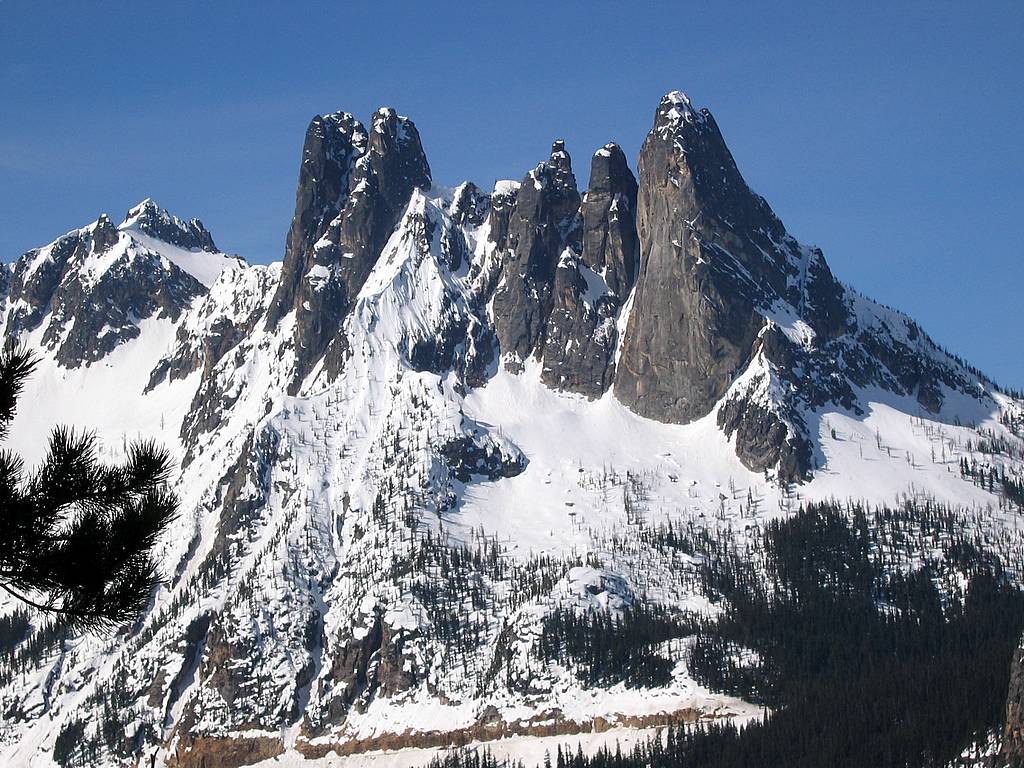
Big Snagtooth(USGS Silver Star)May 14, 2006 |
|||||||||||||||||||||||||||||||||||||||||||||||||||||||||||||||||||||||||||
|
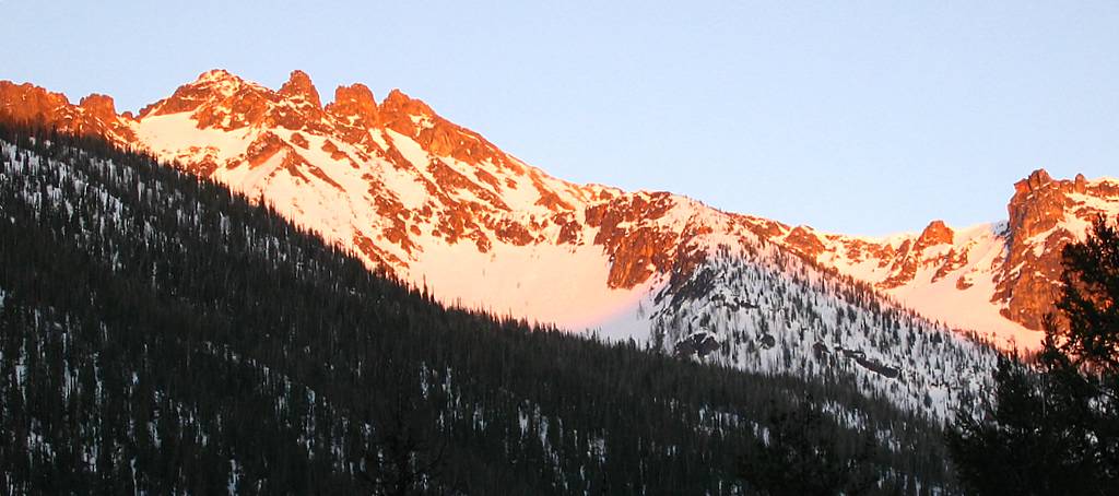
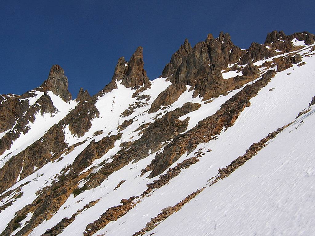
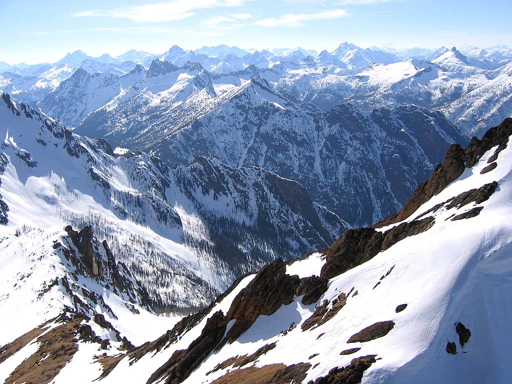
Snagtooth Ridge from North Cascades Highway MP 166 (Click any photo to enlarge)
|
|||||||||||||||||||||||||||||||||||||||||||||||||||||||||||||||||||||||||||
|
|||||||||||||||||||||||||||||||||||||||||||||||||||||||||||||||||||||||||||
|
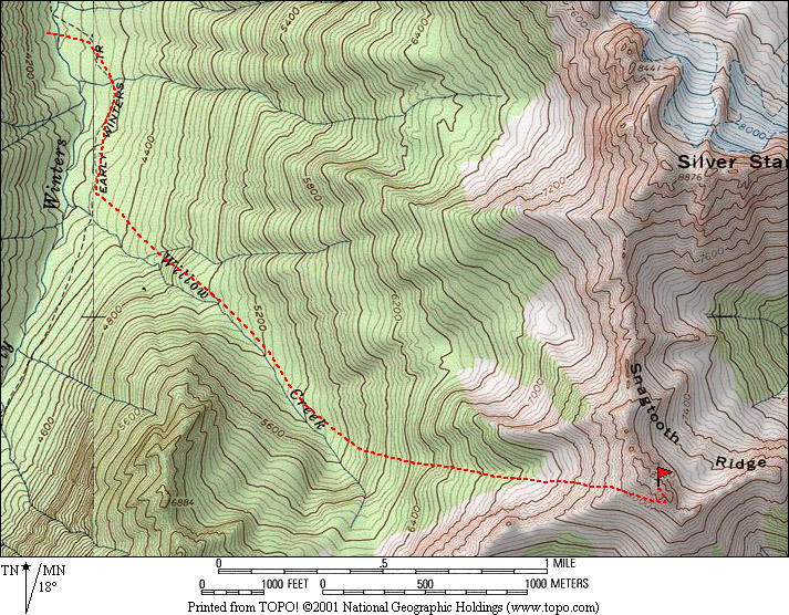
Big Snagtooth doesn’t actually have a trailhead. As with Silver Star, you simply park at the wide turnout just past milepost 166on the North Cascades Highway, about 170 miles from downtown Seattle. This was the third time I’ve made the long drive to Big Snagtooth. The first time I rode with Dale, but we found clouds and drizzle at the turnout, so we returned to Seattle. The second time I rode with Ian and ended up hitchhiking back to Seattle after dark. This time I drove myself, plus needed to make an extra loop down to Seattle to pick up Eric, so I left my parking lot at 3:45am in order to have plenty of time. |
|||||||||||||||||||||||||||||||||||||||||||||||||||||||||||||||||||||||||||
|
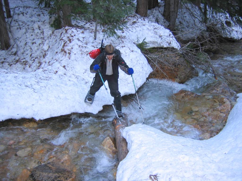
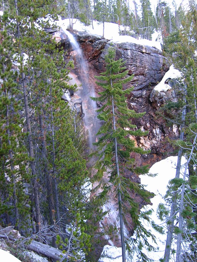
We dropped down to Early Winters Creek and found a crossing without any trouble. Then we angled SSE to intersect Willow Creek. Circa 4600 we found the expected rock band (which includes the waterfall visible from the road), worked our way around it, and continued angling upward and rightward. But something was wrong. We kept going higher, when the valley should have been a broad low-angled walk after the rock band. Finally we realized that we had crossed Willow Creek without every noticing it and traveled way too far up toward the Kangaroo Ridge side. We dropped 400 feet back down into the valley at 5000, which was indeed a nice low-angled walk toward the headwall circa 5800.
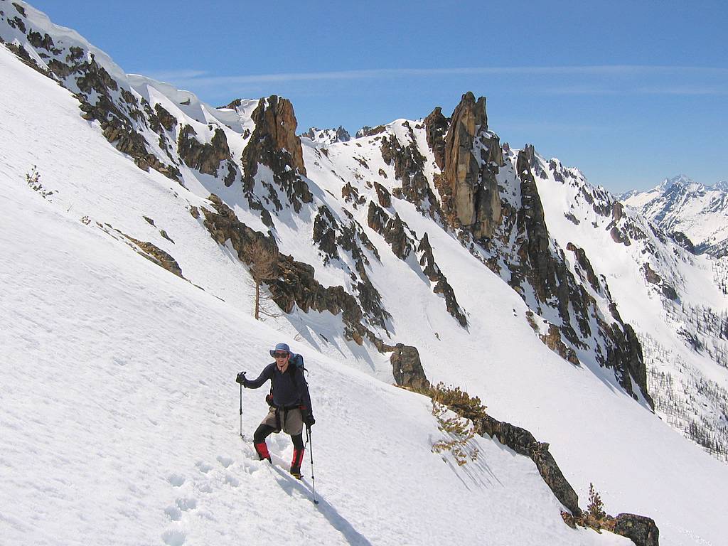
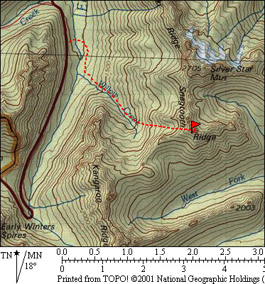
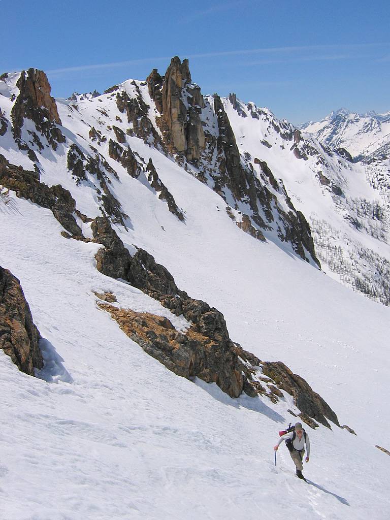
At the top of the creek valley, we turned left and followed the snow slopes eastward up 2000 feet to a minor 8000-foot saddle between Point 7400 and Snagtooth Ridge. (Okay, it’s not really a saddle, since the ridge continues downward, but it’s a very convenient comfortable flat group of rocks.) The snow was perfect for step-kicking, just soft enough to pack down a few inches and make each step solid with little or no effort. Only a small bit or the awful loose scree peaked out of the snow at the very top. |
|
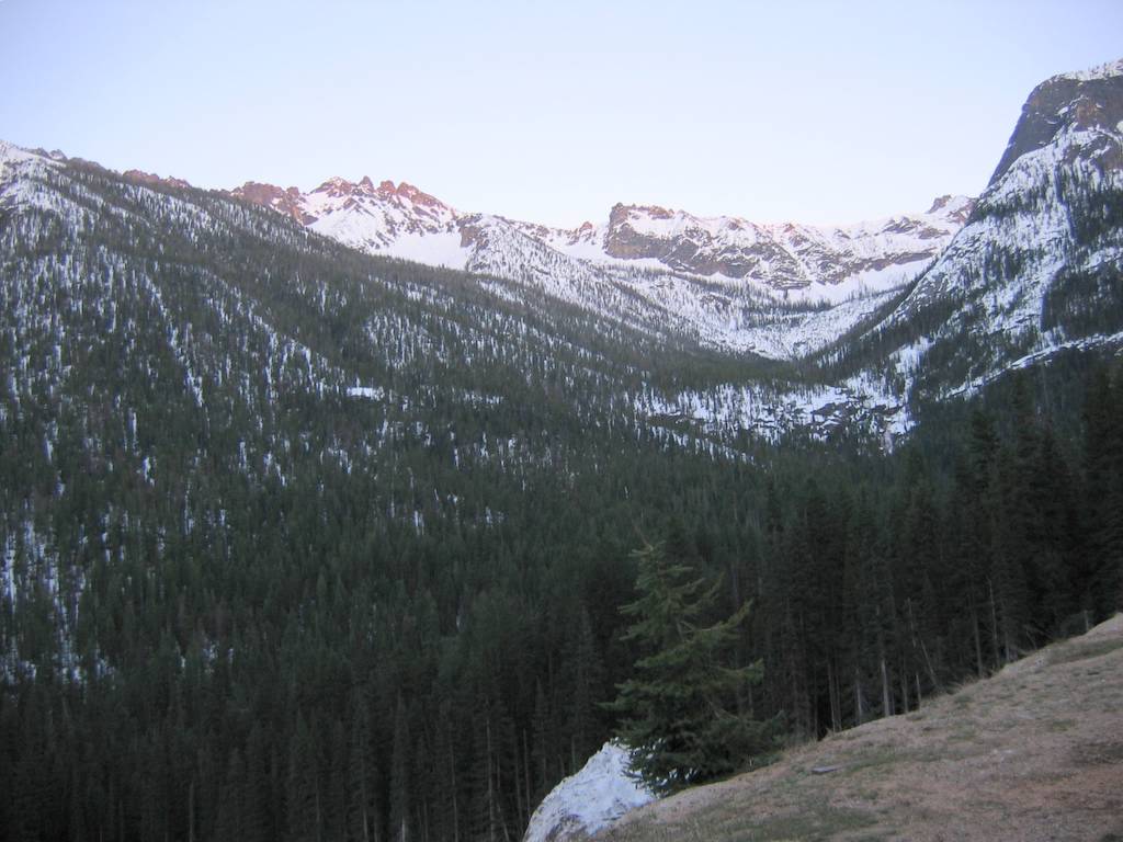
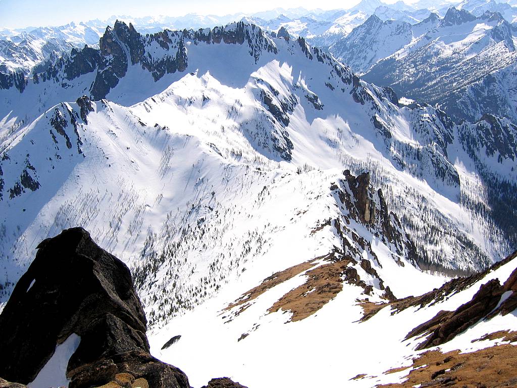
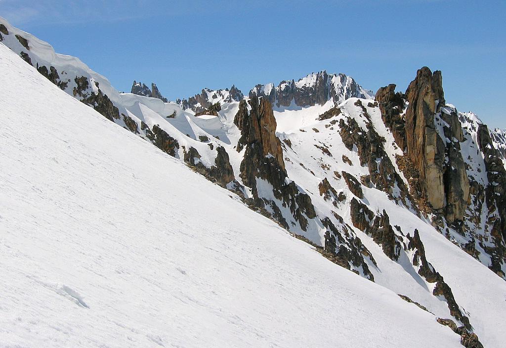
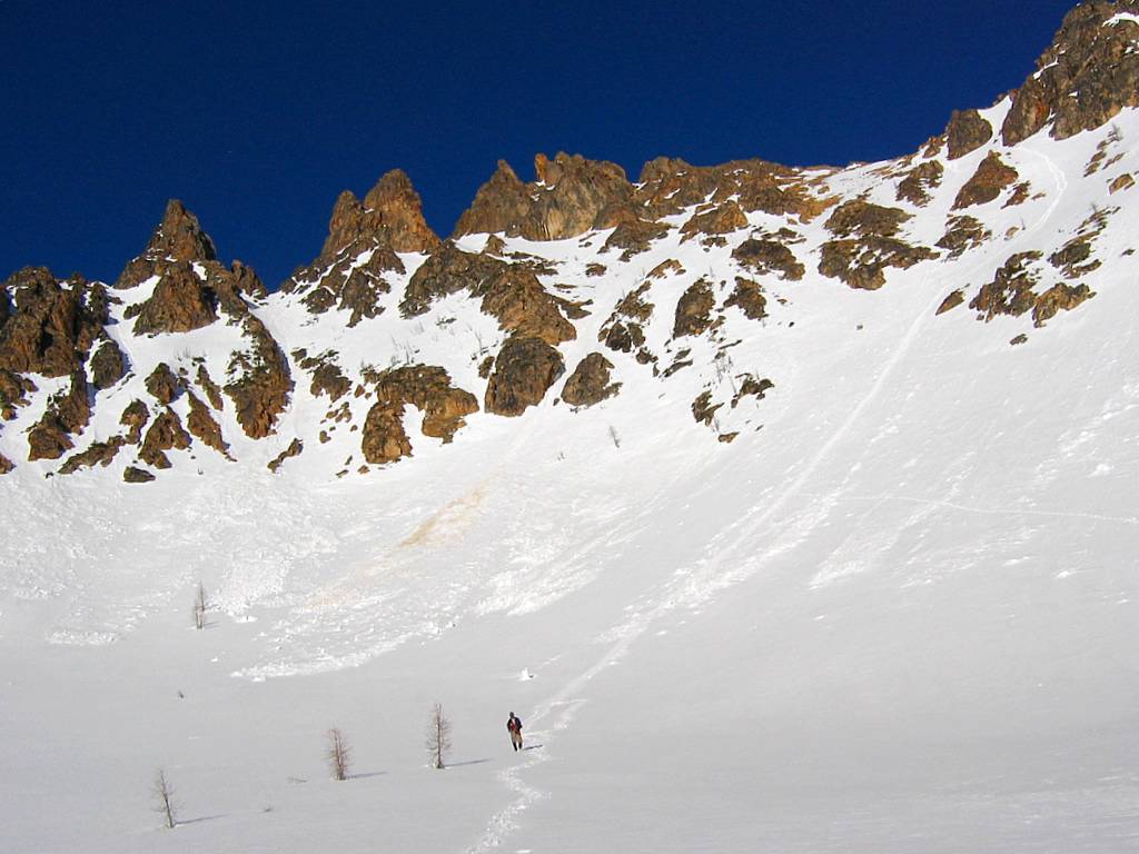
Looking up Willow Creek Valley & Snagtooth Ridge
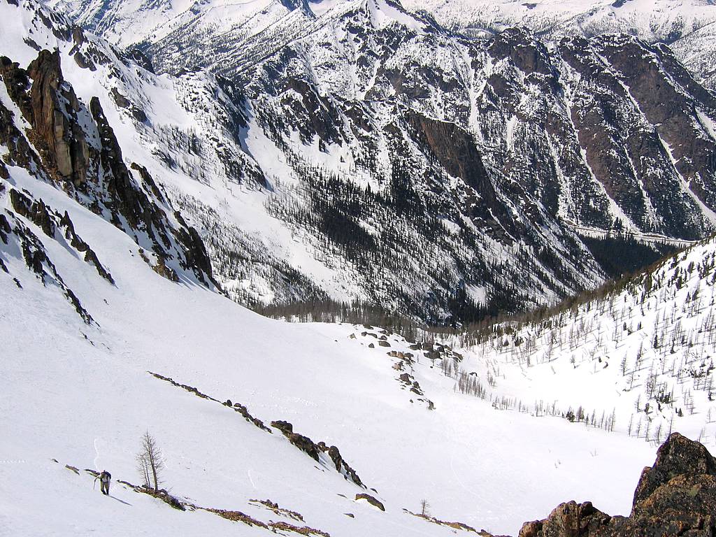
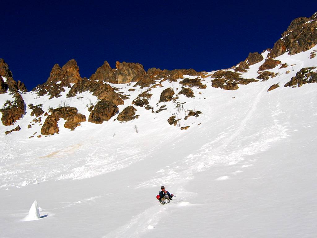
Looking back from the snow bowl to the highway (Note Eric ascending at lower left.) |
|||||||||||||||||||||||||||||||||||||||||||||||||||||||||||||||||||||||||
|
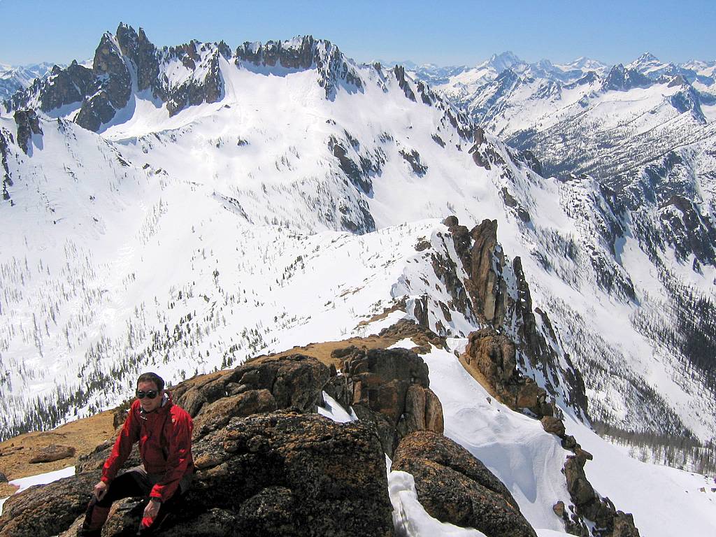
Along the way, we had dramatic views on both sides, with the left dominated by the impressively steep snaggle-teeth of our destination, and the right showing off the snowy cornices and edgy rock of Point 7709, backed by the pointy summit of Kangaroo rising in the background.
|
|||||||||||||||||||||||||||||||||||||||||||||||||||||||||||||||||||||||||||
|
|||||||||||||||||||||||||||||||||||||||||||||||||||||||||||||||||||||||||||
|
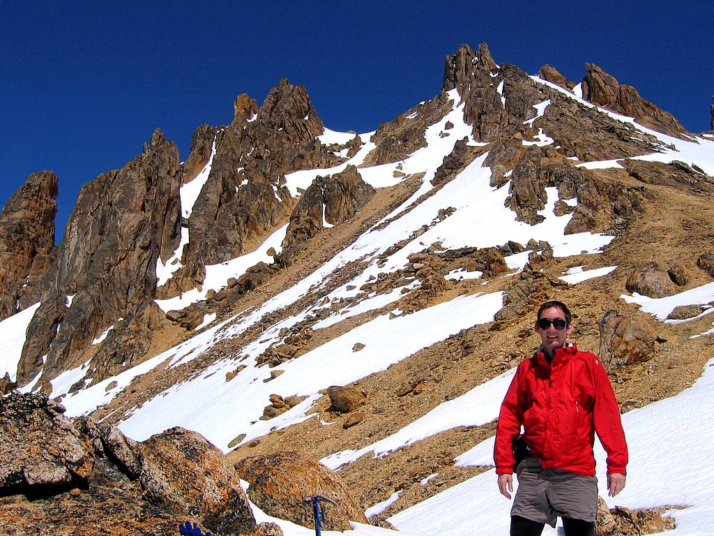
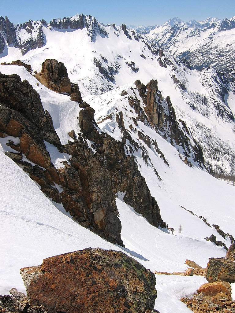
At the saddle, we took a break to enjoy the warm weather and clear views. To the north, we could see scores of peaks on the far side of the highway, and the highway itself far below in the valley. If we looked really close, you could see the slight bump of my car parked alongside the highway 3 miles and 3600 feet below.
|
|||||||||||||||||||||||||||||||||||||||||||||||||||||||||||||||||||||||||||
|
|||||||||||||||||||||||||||||||||||||||||||||||||||||||||||||||||||||||||||
|
We had worn crampons most of the way up, but even the high snow wasn’t crusty today. Since everything around the saddle was either good snow or dry rock, I left my crampons at the saddle. (Strike a note of ominous foreshadowing here. What is the most likely place to find ice on a climb? Perhaps in a steep gully on a high summit outcrop?)
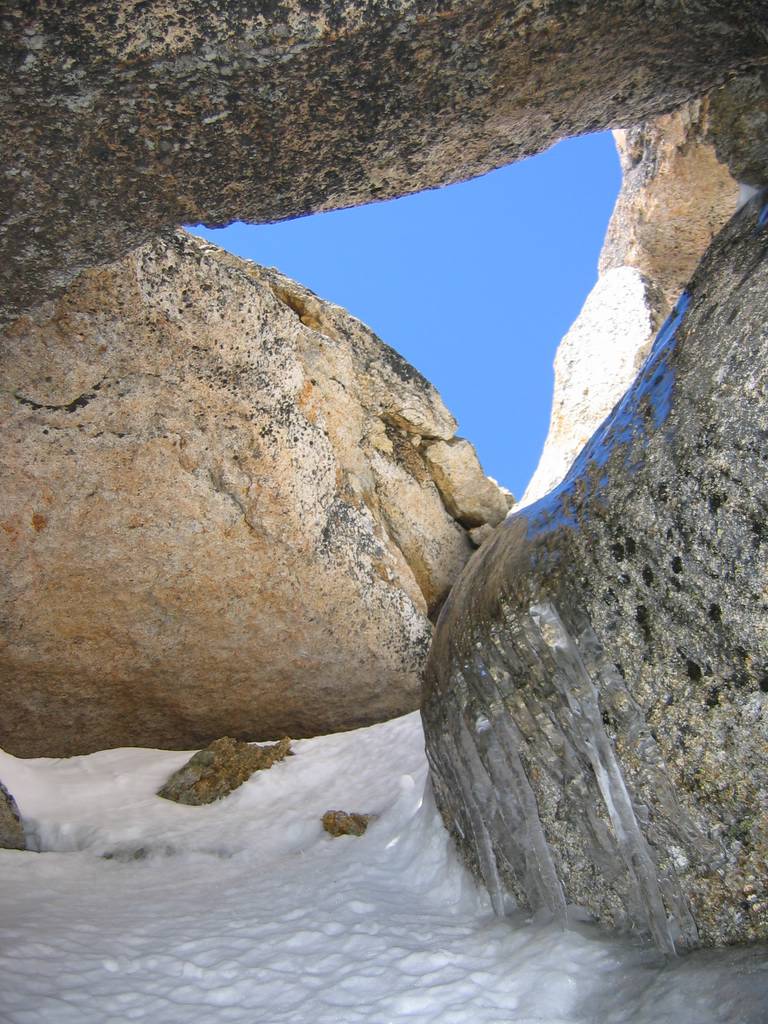
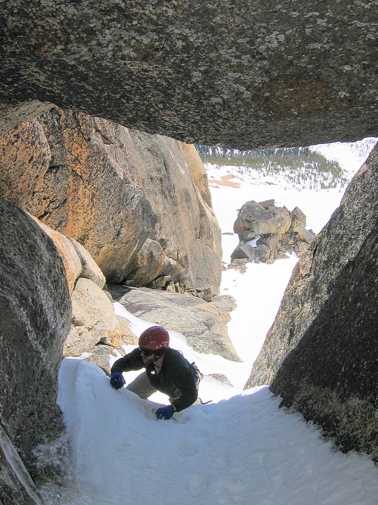
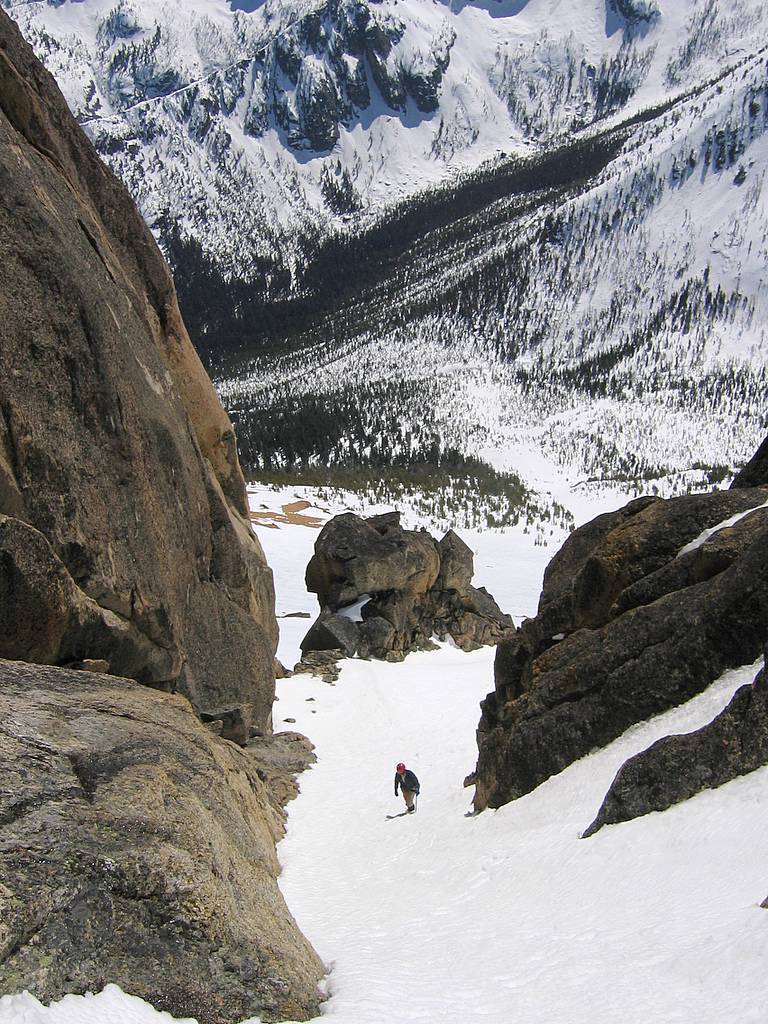
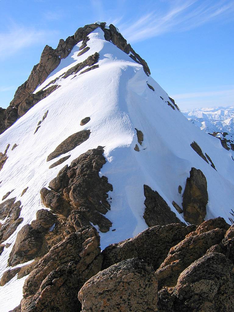
We combined our summit gear into one pack and traversed rightward (further east) to reach the lumpy summit area. Going past the first rib of rock, we found the ascent gully exactly as pictured, leading upward a couple hundred feet and narrowing to pass under a huge triangular chockstone at the top.
|
|||||||||||||||||||||||||||||||||||||||||||||||||||||||||||||||||||||||||||
|
|||||||||||||||||||||||||||||||||||||||||||||||||||||||||||||||||||||||||||
|
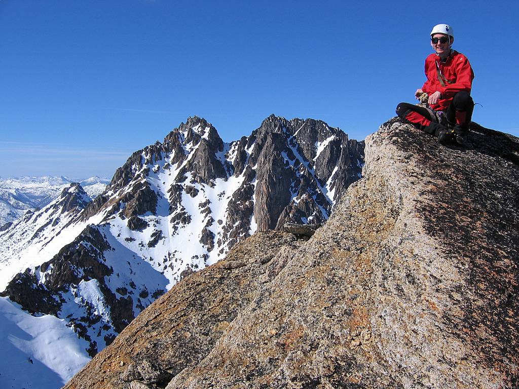
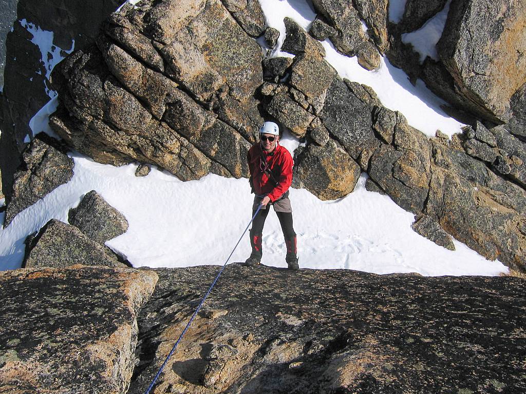
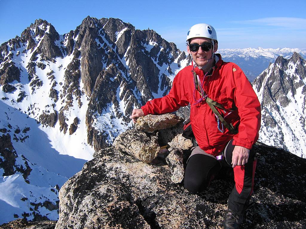
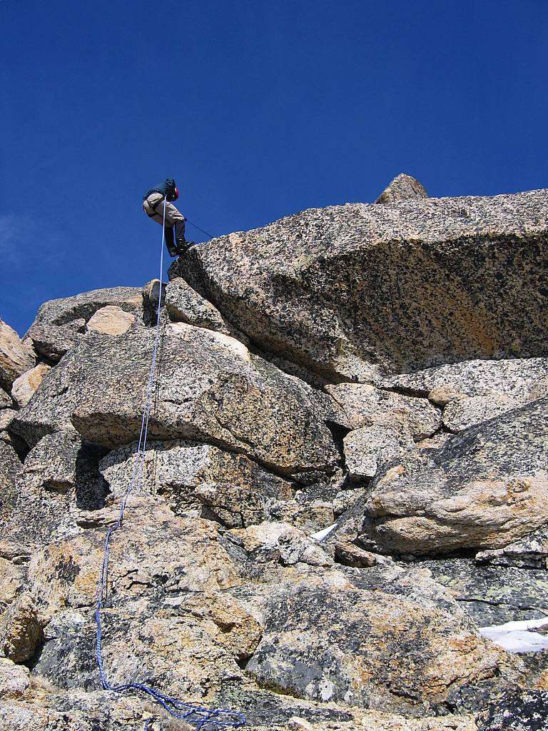
Like most others, we had to do a shoulder stand to get onto the huge tilted summit block. It had a fair number of holds at the edge, but, darn it, all of them were sloping and slippery. Eric was very stalwart letting me step on his shoulders till I worked my way up. On the upper surface of the slab, I round the rappel anchors, which previous climbers had contrived by wedging rocks into a couple large gaps, and belayed Eric up. The summit didn’t provide any comfy place to sit around, just an angled slab leading up to a cairn piled at the top.
Checking the summit register, we discovered that only one person had climbed the peak before us. Well, actually, Faye Pullen had put in a new register in May 2005, and no one else had signed it since. Faye reported belaying herself up when the gully was full of ice – yikes!
|
|||||||||||||||||||||||||||||||||||||||||||||||||||||||||||||||||||||||||||
|
|||||||||||||||||||||||||||||||||||||||||||||||||||||||||||||||||||||||||||
|
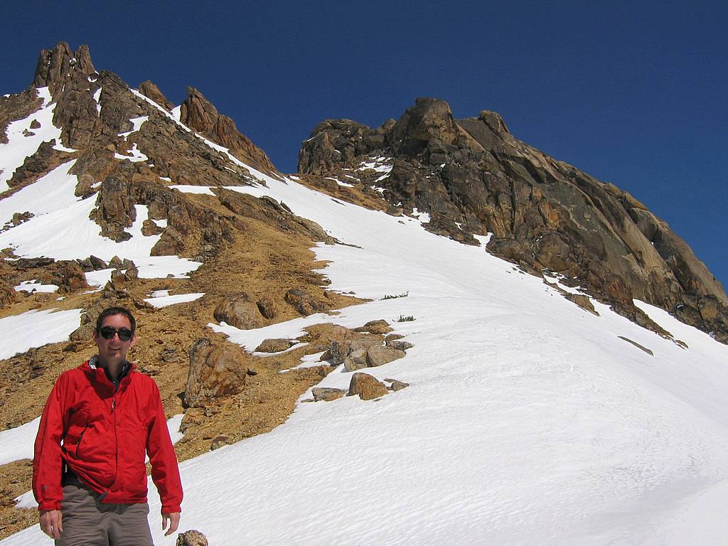
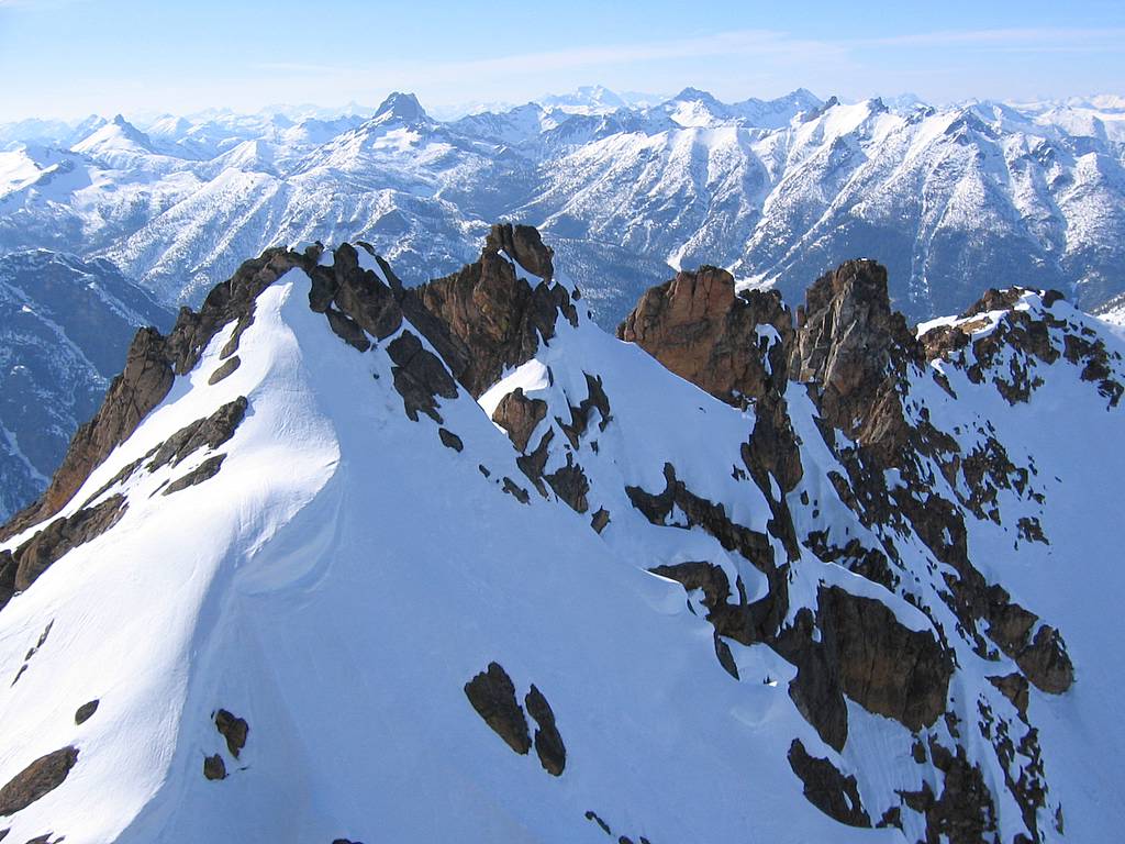
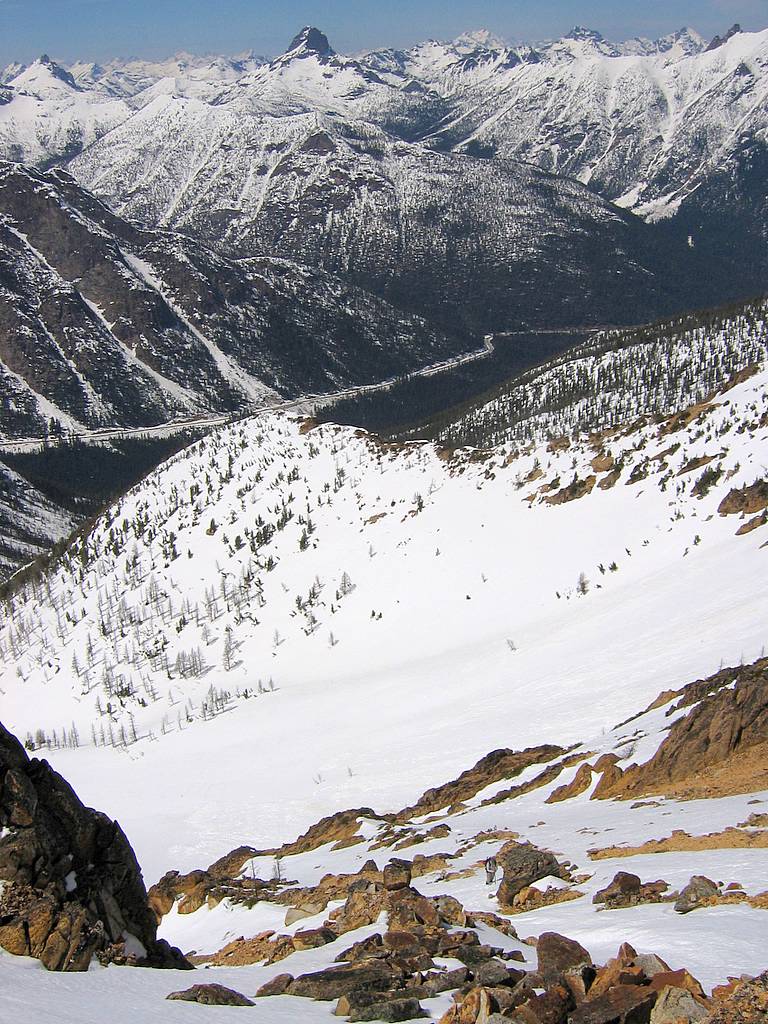
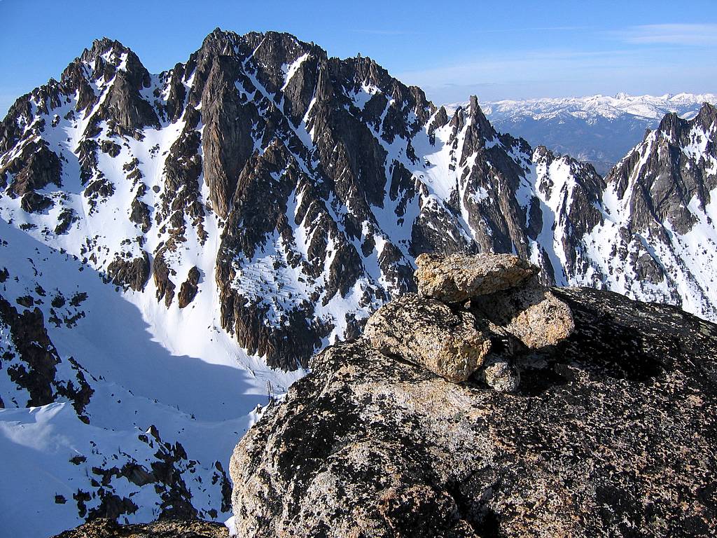
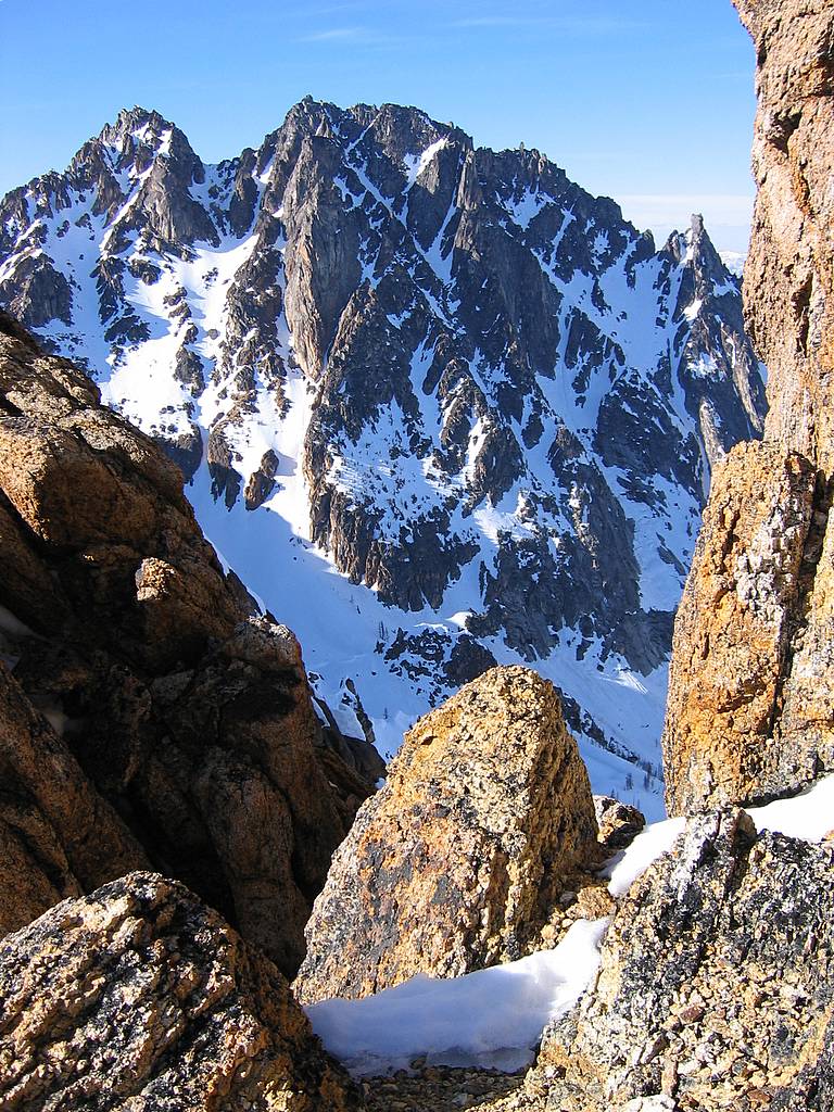
In the clear weather, we could see hundreds of summits stretching out around us. Close by, the back side of Snagtooth Ridge looked impressively steep, with the peaks around Tower Mountain visible above it. Northward we looked across at the giant face of Silver Star and southward out eyes followed the ridgeline curving down and back up to the sharp summit of Kangaroo Ridge, with the Willow Creek valley following Kangaroo Ridge back to the highway on the right. Further out we could see hundreds of peaks stretching from Bonanza and Glacier in the south up into Canada in the north.
We rappelled back down to the base of the summit block, walked downhill a hundred feet or so, and then rappelled to the col between the summit and Willow Tooth. Booth rappels were short, only about 35 feet at most, but the second rappel did provide the excitement of overhanging slightly.
|
|||||||||||||||||||||||||||||||||||||||||||||||||||||||||||||||||||||||||||
|
|||||||||||||||||||||||||||||||||||||||||||||||||||||||||||||||||||||||||||
|
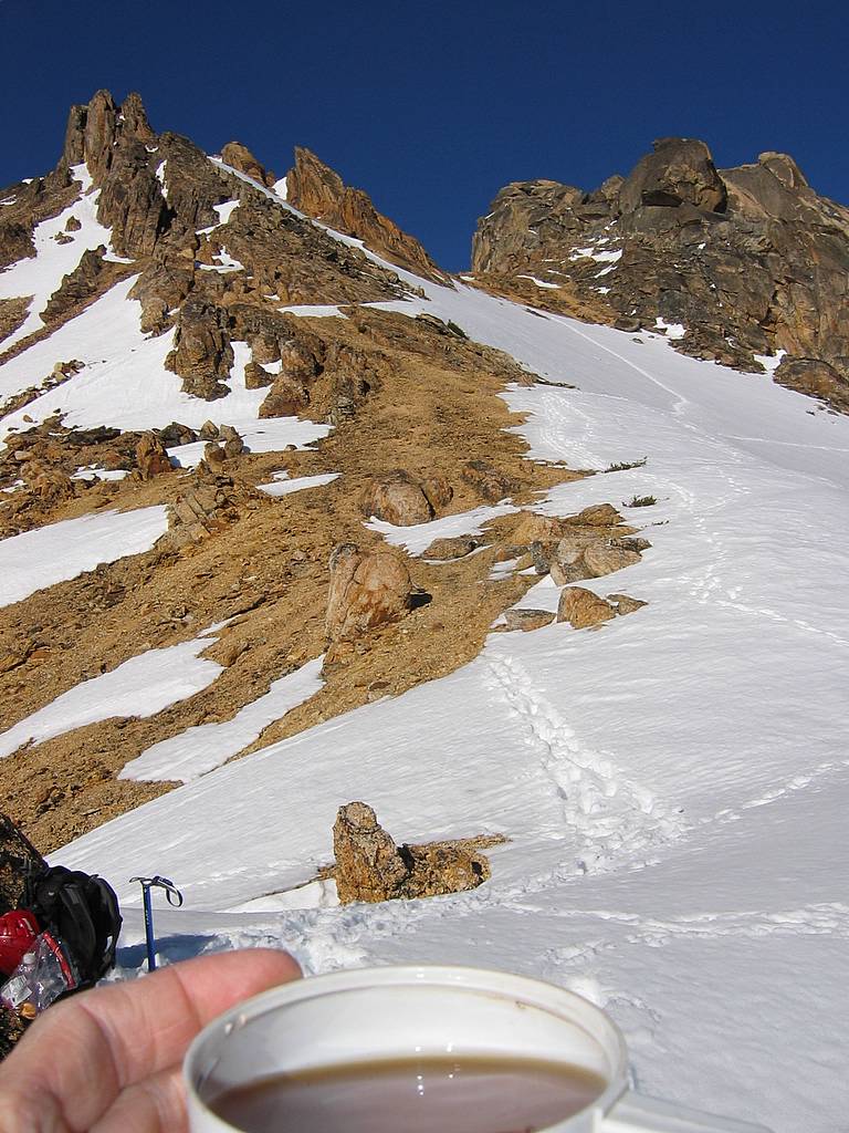
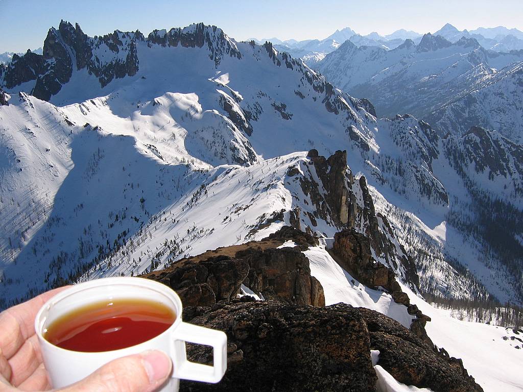
Back at the saddle, we settled in for yet another break, and I enjoyed a very tasty cup of tea.
|
|||||||||||||||||||||||||||||||||||||||||||||||||||||||||||||||||||||||||||
|
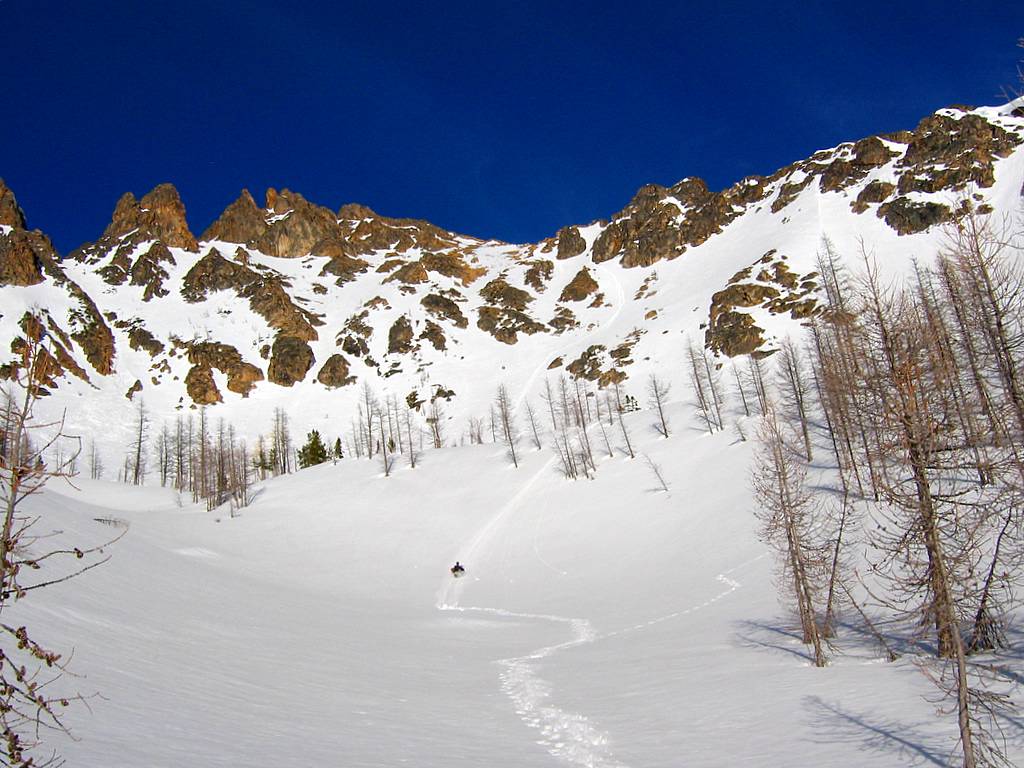
Then we headed down the snow. It was perhaps the best glissading snow I’ve ever sat on, just soft enough to easily control your speed and firm enough to glide for long distances. We probably glissaded about 1600 of the 2000 feet back down to the Willow Creek valley. From there we jogged along nicely on the still-firm snow back to the highway. Circa 4900 feet, we neatly avoided the rock band by angling right till we reached the next small creek, where a rib on the far side let us walk down past the rocks. The creek made a cool little hundred-foot waterfall, shooting out over the lip of the rocks and falling in mid-air down to the base.
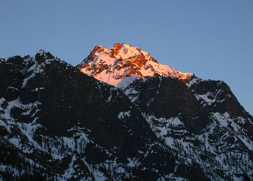
We arrived at the cars right at sunset, where the clear evening light lit up our summit bright red for a few minutes before fading into a long twilight. Then I spent the twilight and night making the long drive home, including a stop in Arlington for a brief nap when I got tired. After dropping off Eric, I got back to my apartment at 12:45am, 21 hours after I’d left.
This was one of the prettiest day trips I’ve done, and made me eager to explore more of the dramatic peaks in the Washington Pass area, especially the surrounding Top 200 peaks like Kangaroo and Silver Horn. With the attractive steep rock, the only drawback is trying to decide which season would be more scenic, spring for the snow or fall for the larches. Guess I’ll have to try some of both.
Statistics: Drive 170 miles, 3:15 from Seattle. Round trip 7 miles. Time: TH - saddle 6:30, break at saddle 0:30, saddle - summit 2:10, break at summit 0:30, summit - saddle 0:50, yet another break at saddle 0:45, saddle - TH 1:45. Total time 13:00. TH 4200, Willow Creek 4000, Saddle 8000, Summit 8330. Net gain 4130. Cumulative gain, with drop to Willow Creek and 400-foot route error, 4930. #81 of Top 100 Peaks for me. |
|
Saddle Tea
Eric Glissading
Silver Star at sunset. |
|||||||||||||||||||||||||||||||||||||||||||||||||||||||||||||||||||||||||
|
Other
Route Info: Very good route description is at http://www.summitpost.org/route/158234/sw-or-w-face.html. The only thing I'd change is that the second rappel is best made to the Big/Willow col, as described in my text above.
Good picture of summit area from saddle is at http://www.summitpost.org/view_object.php?object_id=79348&context_id=151434
Good picture of chockstone gully is at http://www.summitpost.org/view_object.php?object_id=15848&context_id=151434
Good picture of summit block (shoulder stand) is at Roper's web site at http://www.rhinoclimbs.com/Images/BigSnagshoulderstnd.102486.5.jpg. However, we did our shoulder stand from lower ground further to the right, where holds seemed better.
Big Snagtooth Attempt, 3/13/05, failed due to soft snow, lack of equipment, and uncertainty about summit route. Became much bigger problem due to poor communication and missed connection at TH. More Pictures & Maps: (Click any photo above or below to enlarge)
|
|||||||||||||||||||||||||||||||||||||||||||||||||||||||||||||||||||||||||||
|
|
|||||||||||||||||||||||||||||||||||||||||||||||||||||||||||||||||||||||||||
