|
|
||||||||||||||||||||||||||||||||
Damnation Road(USGS Damnation Peak )1/15/05 |
||||||||||||||||||||||||||||||||
|
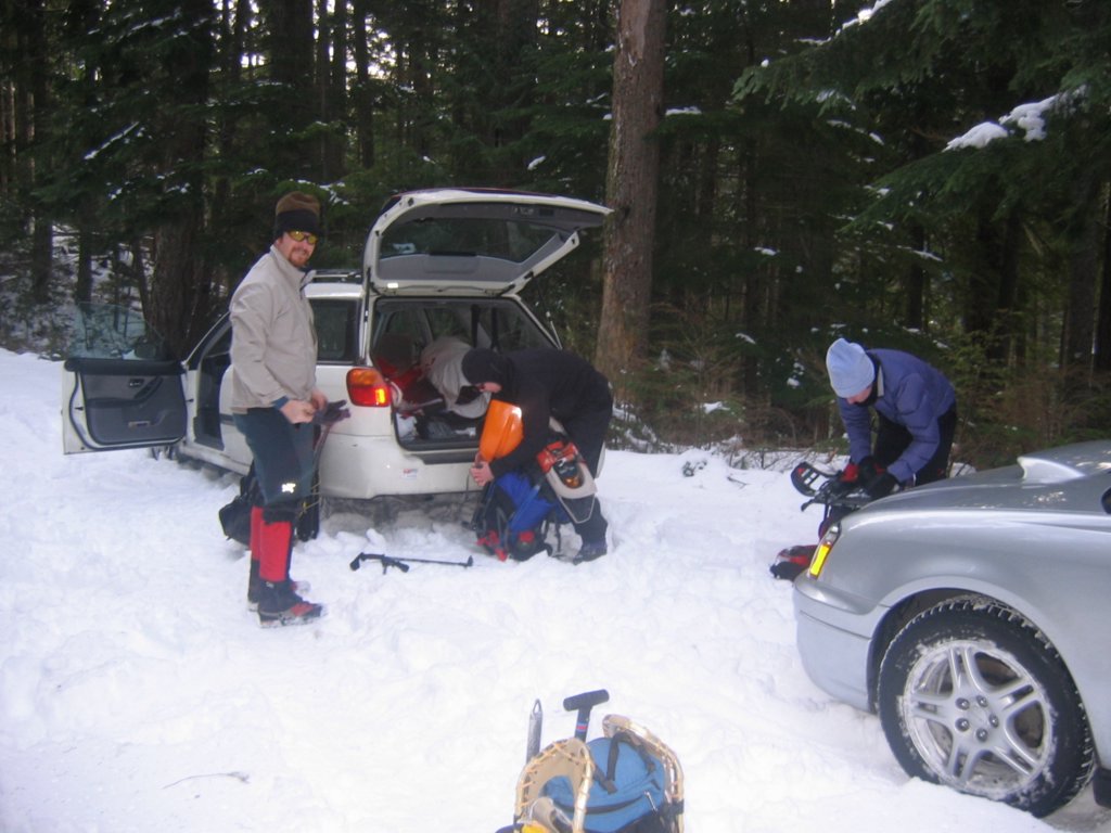
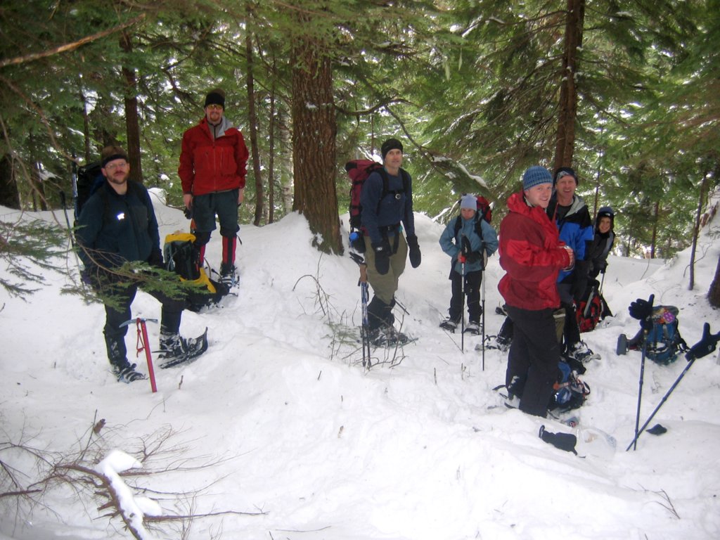
Party: Mountaineers Winter Scramble: Matt Burton, Bari Bookout, Ken Dungan, Carolyn Graham, Eric Johnson, Eileen Kutscha, Jack McLaughlin, Jack Stowe, Ryan Vannier. Highlights: Stand
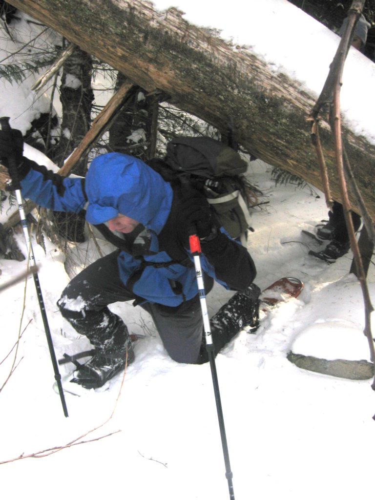
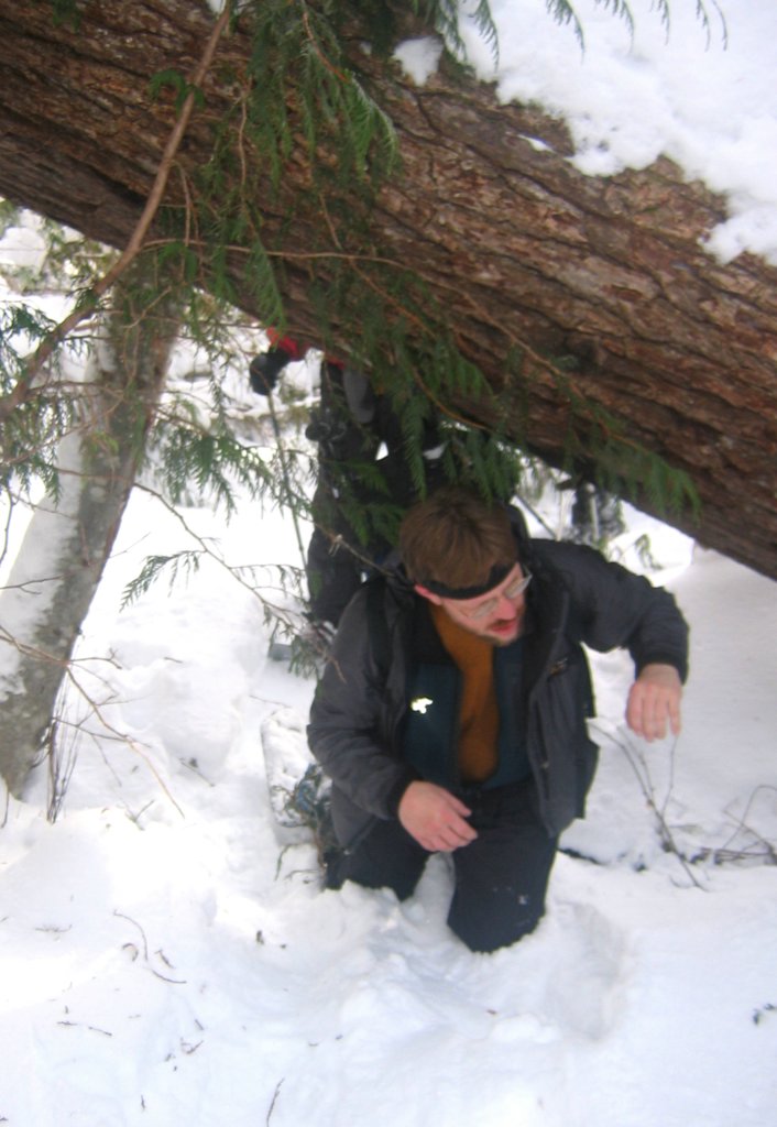
thigh-deep in unconsolidated snow surrounded by small brush. Push some
branches out of your way, set your poles, heave yourself up and forward onto
the next patch of snow. Then crash back down into the snow as the brush
collapses underneath. Repeat this process thousands of times.
Congratulations, you’re hiking on the abandoned Damnation Creek Road!
And you will never get beyond the road in these conditions today. |
||||||||||||||||||||||||||||||||
|
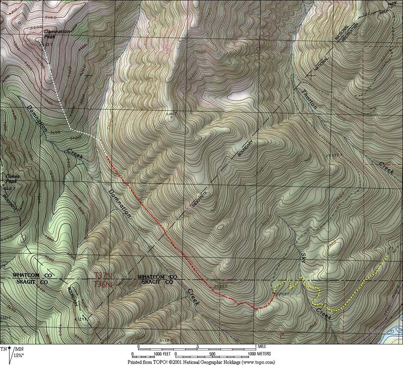
Details: Damnation Peak is situated to be a central viewpoint for the arc of peaks from Bacon to Mystery Ridge to Despair & Triumph. The problem is approaching the peak, because the old logging road along Damnation Creek is badly overgrown with brush. Four years and one day ago, I ascended Damnation Peak in cloudy weather with no views. That year, there was very little snow, with the road almost bare. This year I was hoping there would be a little more snow to cover the brush.
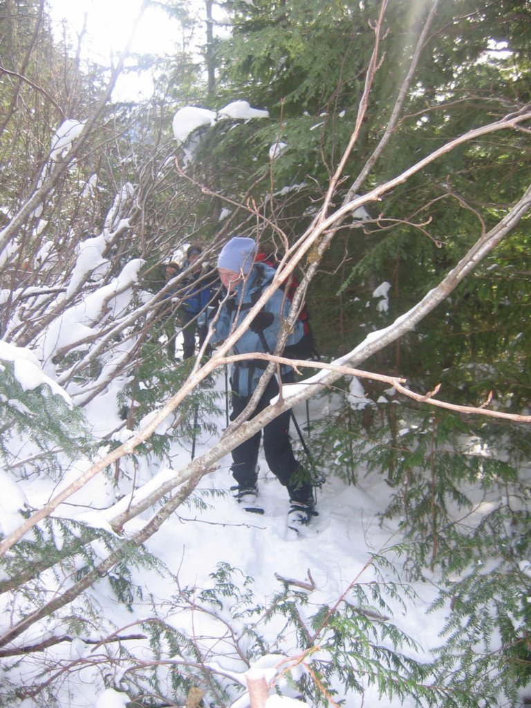
The Damnation Creek road begins at 2243 feet, 3.7 miles up the Thornton Creek Road. The Thornton Road did have snow, enough that we had to park at about 2 miles, 1400 feet. The abandoned Damnation Road had a little over a foot of powdery snow at the start but two feet or more of unconsolidated snow after the first mile. As the brush became thicker and the snow became deeper, our progress became a hopelessly slow wallow.
The brush and snow provided a variety of interesting traveling experiences. Periodically someone would simply throw themselves down onto the road, as they slipped into a snow hole or caught their snowshoe on a branch. In veneration for the road, we sometimes crawled on our knees as we passed under large fallen trees. The best feature was the work that someone had done to cut back the brush. Many small trees were trimmed off about 18 inches above the ground. Early on the road, this was helpful. Later, it made a perfect snowshoe trap hiding under the deeper snow. At least half a dozen times, I found my snowshoe impaled through the binding hole as it dropped through the snow onto a tree stub. After you fall forward, it's great fun to try to lift your rear foot vertically off the stub to get free of the trap.
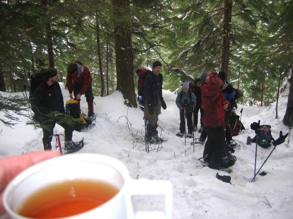
At about 3100 feet, 2.2 miles up the road, we paused for a break in the woods. I decided that there was no way to reach the summit by a reasonable time. With poor snow conditions and increasing clouds, we agreed to turn back. Since this was literally the "end of the road" for today, I decided to drink my summit tea, and burned my tongue.
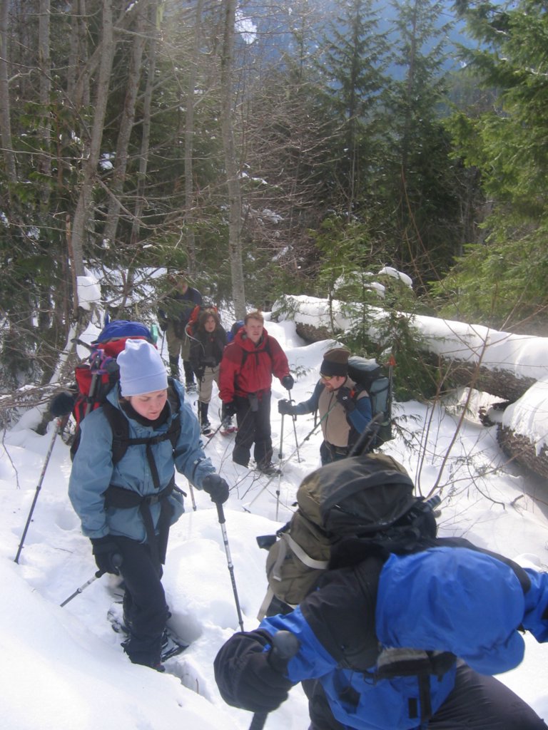
With our tracks packed down in the snow, the return was surprisingly easy traveling. The rest of the party was very gracious about the experience. Perhaps it will make everyone's other trips seem good by comparison.
This trip might work better in spring snow, but the Damnation road might melt out too much by the time the Thornton road melted enough. I still want the winter view, so I'll try it again eventually. Statistics: Round trip 7.5 miles. Parked at 1400. Damnation Road 2243. Stopped at 3200. Metered cumulative gain 2010. Approach 3:15, lunch 0:30, exit 1:50. Drive from Seattle 2:30. |
|
|||||||||||||||||||||||||||||||
|
|
||||||||||||||||||||||||||||||||
|
Route Info: Drive US20 east from Marblemount 11.7 miles to Thornton Creek Road #3745, between mileposts 117 & 118. Drive Thornton Creek Road 3.7 miles to where the road makes a sharp right turn and a spur road branches left, blocked by several large boulders, 2243 feet. Follow the road above Damnation Creek about 2.5 miles, to about 3200 feet. The road is very overgrown with brush. From the end of the road, descend across Damnation Creek to an open slope on the east flank of the peak. Climb up directly to the rounded ridge which has scattered trees. Follow the ridge which broadens and opens about 4500 and continue to the summit.
Pictures & Maps:
|
||||||||||||||||||||||||||||||||
|
|
||||||||||||||||||||||||||||||||